


Complete set of six maps of Calabria from the 'Atlante Geografico del Regno di Napoli'
RIZZI-ZANNONI, Giovanni Antonio.
[Six untitled maps of Calabria.]
Naples, 1794-1812. Six sheets, each 525 x 770mm.
Each sheet with the ink stamp of the 'Depot de la Marine'.
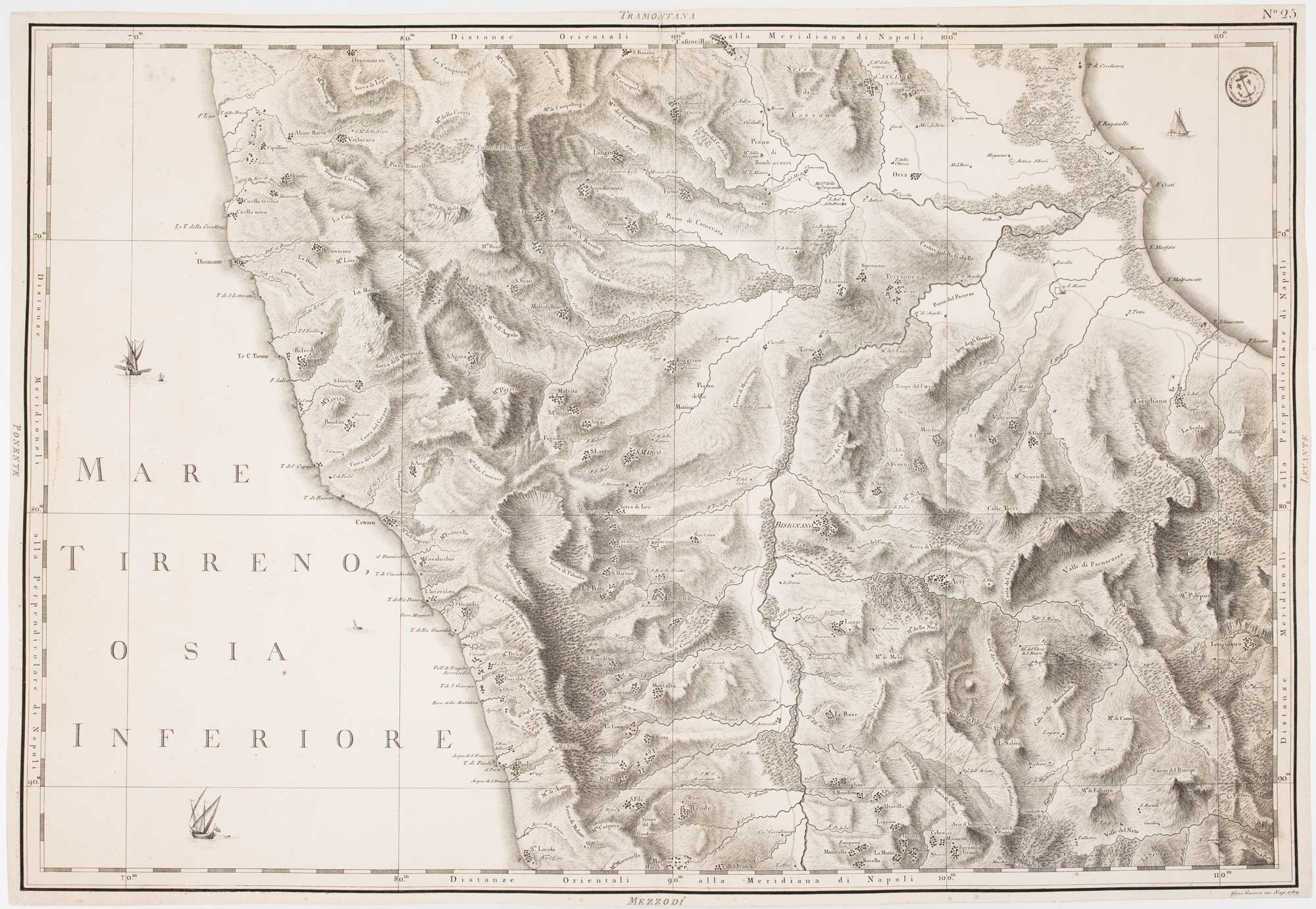
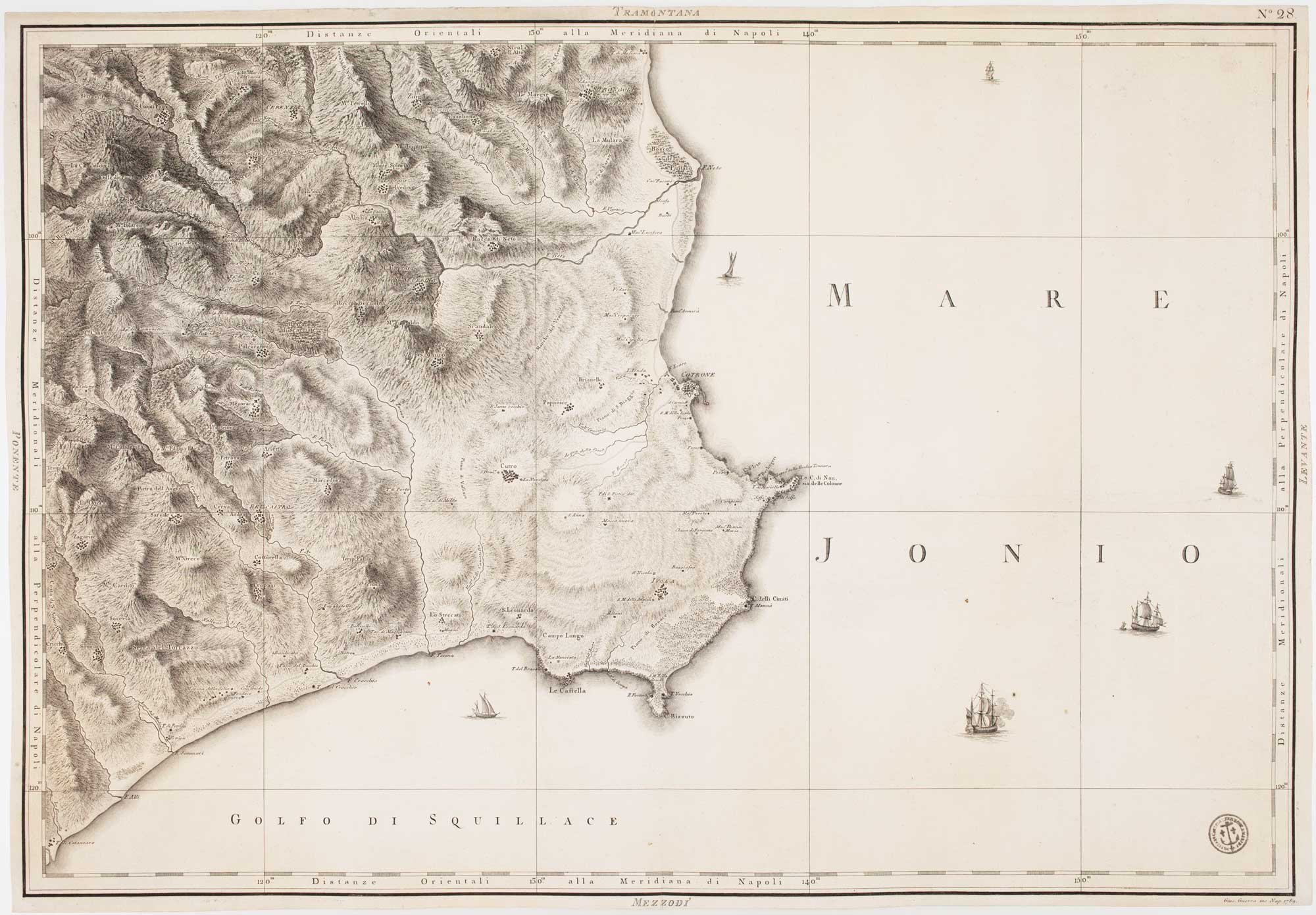
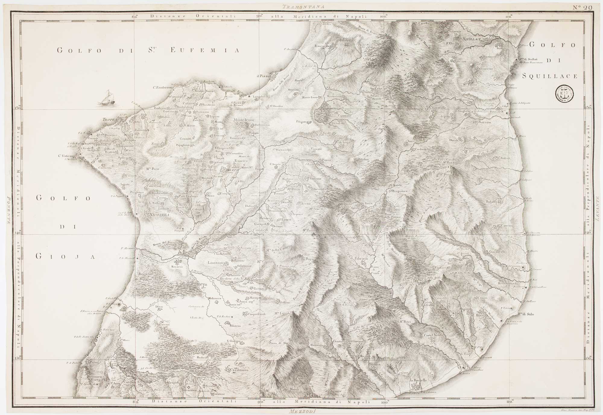
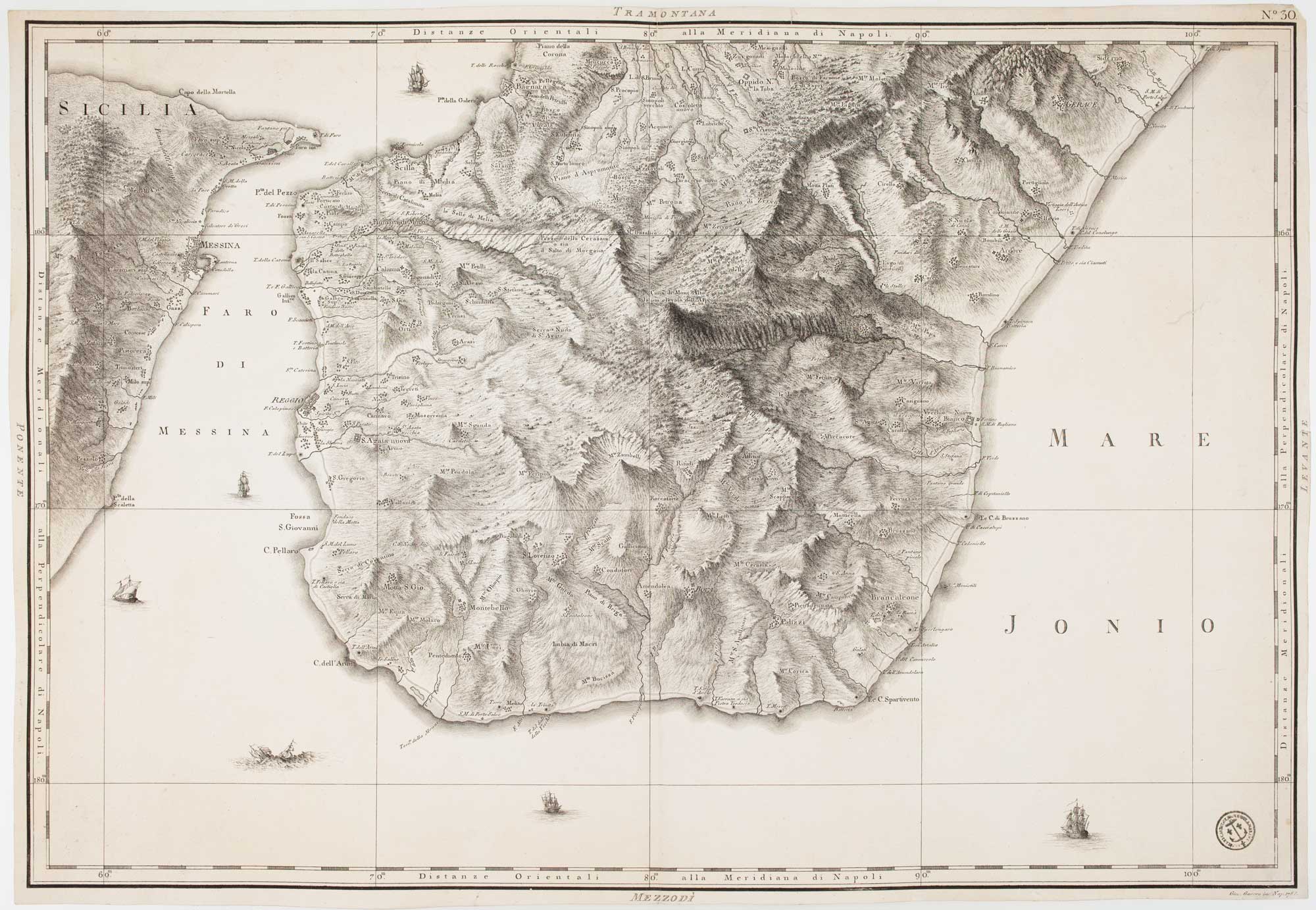
The six maps of the whole region of Calabria engraved by Giuseppe Guerra in 1794 for Rizzi-Zannoni's 'Atlante Geografico del Regno di Napoli', completed in 1812. The incredibly-detailed sheets show relief with hachuring and have vignette ships decorating the seas.
Rizzi-Zannoni (1736-1814) started his 31-sheet map of the Kingdom of Naples in 1788, under the Bourbon monarch Ferdinand IV. He continued his work under the rules of Joseph Bonaparte and Joachim Murat, taking the role of head of the 'Deposito Topografico' in 1807. The quality of the work has led him to be regarded as the most influential Italian cartographer since Magini.
Stock ID : 15474
£650
£650

Complete set of six maps of Calabria from the 'Atlante Geografico del Regno di Napoli'
RIZZI-ZANNONI, Giovanni Antonio.
[Six untitled maps of Calabria.]
Naples, 1794-1812. Six sheets, each 525 x 770mm.
Each sheet with the ink stamp of the 'Depot de la Marine'.
The six maps of the whole region of Calabria engraved by Giuseppe Guerra in 1794 for Rizzi-Zannoni's 'Atlante Geografico del Regno di Napoli', completed in 1812. The incredibly-detailed sheets show relief with hachuring and have vignette ships decorating the seas.
Rizzi-Zannoni (1736-1814) started his 31-sheet map of the Kingdom of Naples in 1788, under the Bourbon monarch Ferdinand IV. He continued his work under the rules of Joseph Bonaparte and Joachim Murat, taking the role of head of the 'Deposito Topografico' in 1807. The quality of the work has led him to be regarded as the most influential Italian cartographer since Magini.
Stock ID : 15474
£650
£650


Altea Antique Maps & Charts
Altea Gallery Ltd, 35 St George Street
London
W1S 2FN
United Kingdom
Tel: +44 20 7491 0010
info@alteagallery.com
Sitemap :

