A 17th century chart of the eastern Mediterranean in fine colour.
£1,600
In stock
De Wit's fine sea chart of the Eastern Mediterranean, showing from the east coasts of Corsica and Sardinia to Cyprus and the Holy Land.
This example was issued by the Ottens brothers' edition of Louis Renard's j 'Atlas van Zeevaart'. The superb title cartouches represent the struggle between the West and the Turks for control of the sea, and the vignette ships include a battle between a galleon and a galley. A very fine example
Additional information
| Dimensions | 580 × 470 mm |
|---|---|
| Cartographer | |
| Date | 1745 |
| Extra Info | Orientalior districtus Maris Mediterranei. t'Ooster gedeelte van de Middelandse Zee. |
| Publication | Amsterdam: R. & J. Ottens, c.1745. Original colour. 470 x 580mm. |
| Condition | A good example. |
| References | – |
Related Items
Related products
-

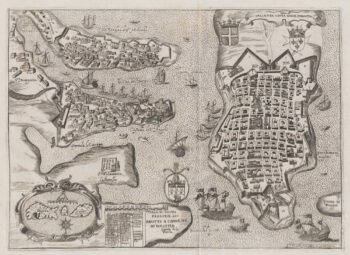
The Knights Hospitallers in Valletta
£1,000NABERAT, Anne de.
Published In 1629
Stock No. 20122 -

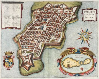
A 17th century plan of Valletta
£650MERIAN, Matthaus.
Published In 1638
Stock No. 20690 -

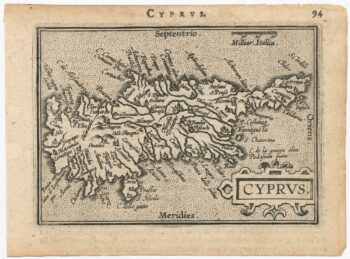
The scarce second Galle plate for Cyprus used in the ‘Epitome’
£500ORTELIUS, Abraham.
Published In 1598
Stock No. 23195 -

A 16th century miniature map of Malta
£400LANGENES, Barent.
Published In 1599
Stock No. 21326