Showing 1–9 of 16 results
-

A very scarce handkerchief map of London
£2,800Anonymous.
Published In 1832
Stock No. 20799 -

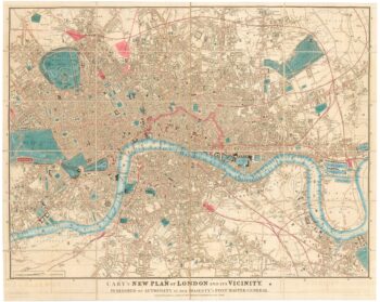
Detailed map of London during the Great Exhibition of 1851
£1,400CARY, John.
Published In 1851
Stock No. 23829 -

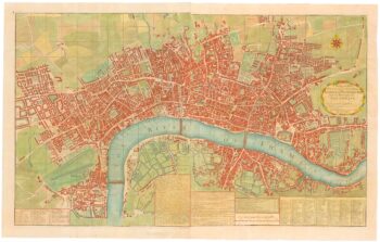
A two-sheet map of 18th century London
£2,200SMITH, Joseph.
Published In 1795
Stock No. 23337 -

St James’s from an important large-scale survey of London
£1,500HORWOOD, Richard.
Published In 1795
Stock No. 24402 -

Pimlico and Belgravia from an important large-scale survey of London
£700HORWOOD, Richard.
Published In 1799
Stock No. 24400 -

Early woodblock map of Elizabethan London
£1,600MUNSTER, Sebastian.
Published In 1628
Stock No. 24366 -

The first available printed map of London
£8,500BRAUN, Georg & HOGENBERG, Frans.
Published In 1579
Stock No. 18303 -

Town plan of Georgian London with illustrated borders
£2,800LANGLEY & BELCH.
Published In 1812
Stock No. 22899 -

A detailed plan of Fitzrovia at the end of the 18th century
£500HORWOOD, Richard.
Published In 1794
Stock No. 20824