A German edition of a landmark map of New England
£5,000
Out of stock
A striking wall map of New England, with inset plans of Boston and Boston Harbour and a title cartouche featuring the Pilgrim Fathers landing on Plymouth Rock in 1620.
The map shows the coast from Long Island Sound north to Casco Bay and inland to the Hudson River and Lake Champlain, with the 'Kats Kill Mountains'.
It is close copy of Braddock Mead's map of New England, the most important and map of the area published before the American Revolution, originally published by Thomas Jefferys in 1757. However this version is based on a later state, with the Boston plan added.
Additional information
| Dimensions | 895 × 1030 mm |
|---|---|
| Cartographer | |
| Date | 1776 |
| Publication | Augusburg: Tobias Conrad Lotter, 1776. Original colour. Four sheets conjoined, total 1030 x 985mm. |
| Condition | A good example. |
| References | – |
Related Items
Related products
-

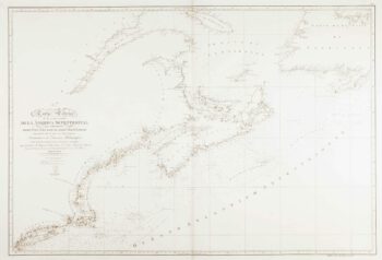
An uncommon Spanish sea chart of the Eastern Seaboard
£1,700NOGUERA, C.
Published In 1860
Stock No. 11858 -

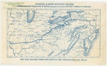
An advert for an American railway
£750Anonymous.
Published In 1865
Stock No. 24455 -

18th century map of the Eastern Seaboard
£750ROBERT DE VAUGONDY, Didier.
Published In 1770
Stock No. 24555 -
An uncommon Spanish sea chart of the Eastern Seaboard
£550NOGUERA, C.
Published In 1860
Stock No. 11859