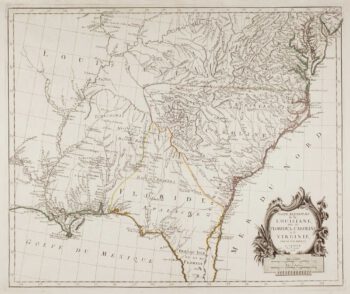
Influential map of the Eastern Seaboard
£7,500
Out of stock
A superb map of the Eastern Seaboard from Cape Lookout to Florida, with Cuba and the Bahamas, by the official artist of the second French Huguenot expedition to their colony at Charlefort, 1564. When the Spanish destroyed the colony of 'heretics' Le Moyne fled into the wild, but eventually joined other Huguenot émigres in London. Working from memory (having lost most of his possessions in the swamps) he produced this map and a number of watercolours (only one now extant). In 1587 de Bry met le Moyne in London and tried to buy his papers, but as le Moyne was working for Sir Walter Raleigh he refused to sell. However le Moyne died the following year and de Bry was able to buy this map and some sketches from his widow.
Of interest is the large expanse of water at the top of the map, either representing the Great Lakes or Verrazzano's Sea; the waterfall, believed to be based on the local Indians' accounts of Niagara; and Port Royal named on a map for the first time.
Additional information
| Cartographer | |
|---|---|
| Date | 1591 |
| Extra Info | Floridae Americae Provinciae Recens & exactissima descriptio… |
| Publication | Frankfurt, Theodore de Bry, 1591. 370 x 360mm. |
| Condition | Strengthened with thin tissue on verso of top left corner; an excellent example with a fine impression. |
| References | BURDEN: 79; CUMMING: 14; GOSS: Mapping of North America 16, 'one of the most attractive maps of North America'. |
Related Items
Related products
-

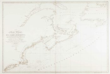
An uncommon Spanish sea chart of the Eastern Seaboard
£1,700NOGUERA, C.
Published In 1860
Stock No. 11858 -

18th century map of the Eastern Seaboard
£750ROBERT DE VAUGONDY, Didier.
Published In 1770
Stock No. 24555 -
An uncommon Spanish sea chart of the Eastern Seaboard
£550NOGUERA, C.
Published In 1860
Stock No. 11859 -

18th century map of the American South East
£500SANTINI, Francesco & Paolo.
Published In 1776
Stock No. 9346