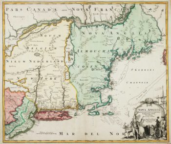
The Speed map of New England
£6,500
In stock
An important map of the two provinces published a little over a decade after the English took New York City from the Dutch in 1664. It shows the Eastern Seaboard from Pennobscot south to Delaware Bay, with the cartography taken from the Jansson/Visscher 'Belgii Novi' map, although it omits most of Chesapeake Bay as that area was detailed on another new map. On the reverse is a letterpress text, 'The Description of New England'.
Although the map is usually attributed to Speed, it was engraved by Francis Lamb for the 1676 edition of Speed's 'Prospect of the Most Famous Parts of the World' (the first English world atlas, first published 1627), by which time Speed had been dead for nearly half a century.
Additional information
| Dimensions | 505 × 385 mm |
|---|---|
| Cartographer | |
| Date | 1676 |
| Extra Info | A Map of New England and New York. |
| Publication | London: Thomas Bassett & Richard Chiswell, 1676. Coloured. 385 x 505mm. |
| Condition | A good example. |
| References | – |
Related Items
Related products
-

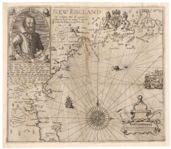
A rare German edition of John Smith’s map of New England
£9,000SMITH, John.
Published In 1617
Stock No. 21888 -

An uncommon Spanish sea chart of the Eastern Seaboard
£1,700NOGUERA, C.
Published In 1860
Stock No. 11858 -

The English colonies on the north-east seaboard of America
£1,450HOMANN, Johann Baptist.
Published In 1725
Stock No. 11207 -

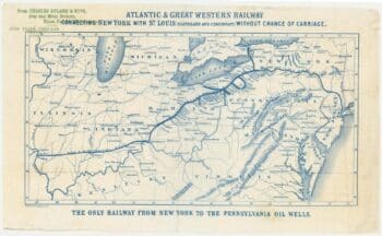
An advert for an American railway
£750Anonymous.
Published In 1865
Stock No. 24455