A political map of the Partition of British India
£1,800
In stock
A poster map of India and Pakistan published less than two years after the partition of British India. The key marks land altitude, the main industries and where rice, tea and jute are grown. It depicts the disputed areas of Kashmir and Hyderbad and notes the strengths of India and Pakistan and that the 'chief needs of both are food and power'.
The map was published by the 'Bureau of Current Affairs', which was set up in 1940 as the 'Army Bureau of Current Affairs' to educate and mentally stimulate the armed forces. After the war it turned to the education of civilians, under the auspices of the Carnegie Trust.
Additional information
| Dimensions | 1015 × 765 mm |
|---|---|
| Cartographer | |
| Date | 1949 |
| Extra Info | Map Review. No . 70. Two New Dominions. |
| Publication | London: Bureau of Current Affairs, 1949. Colour lithograph. Sheet 765 x 1015mm. |
| Condition | A good example. |
| References | – |
Related Items
Related products
-

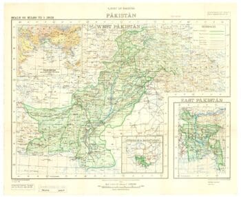
One of the first maps to show Pakistan as an independent state
£2,500SURVEY OF PAKISTAN.
Published In 1950
Stock No. 24297 -

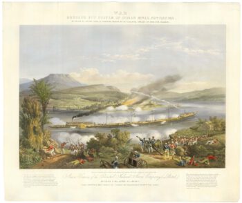
A rare pair of illustrations of proposed ships for India’s rivers
£2,000BOURNE, John.
Published In 1858
Stock No. 21899 -

A detailed chart of the Bay of Bengal
£800HOBBS, John Stratton.
Published In 1850
Stock No. 17540 -

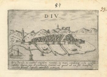
A 16th century Italian plan of Diu Island
£200VALEGIO, Francesco.
Published In 1598
Stock No. 24140