A 16th century woodcut map of England and Wales
£750
In stock
A scarce map of England and Wales, as divided between the Saxon kingdoms before the Norman Conquest, issued in William Lambard's 'A Perambulation of Kent. It is a close copy of the map engraved on copper by Lyne for the first edition of 1575, which, in turn, was probably reduced (both in size and content) from a manuscript map by Laurence Nowell of c.1564.
Additional information
| Dimensions | 140 × 185 mm |
|---|---|
| Cartographer | |
| Date | 1596 |
| Extra Info | Angliae Heptarchia. |
| Publication | London: Edmund Bolissant, 1596. Woodcut, sheet 185 x 140mm. |
| Condition | Tiny pinhole in map, a little wear to edges. |
| References | SHIRLEY: 190. |
Related Items
Related products
-

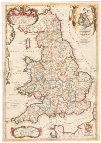
A scarce two-sheet map of England and Wales with side panels
£3,000WILLDEY, George.
Published In 1715
Stock No. 24165 -

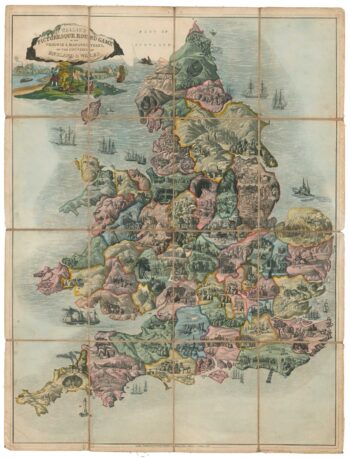
A Georgian ”goose game” of England and Wales
£1,200WALLIS, Edward.
Published In 1830
Stock No. 18380 -

An 17th century two-sheet map of England and Wales
£750CORONELLI, Vincenzo Maria.
Published In 1691
Stock No. 21517 -

England divided into the Saxon Heptarchy
£380SEUTTER, Matthaus.
Published In 1740
Stock No. 22311