A scarce map of Scotland
£1,000
In stock
An uncommon map of Scotland, with a decorative title cartouche and an inset of the Shetlands. Originally published by Christopher Browne in 1705, this example has an additional title added by Senex. The name of the engraver, John Harris, is only faintly visible off Kinnaird Head.
It was Robert Gordon (1580-1661) who revised Timothy Pont's maps, allowing the publication of the first atlas of Scotland, Jan Blaeu's 'Theatrum Scotiae', 1654.
Additional information
| Dimensions | 470 × 560 mm |
|---|---|
| Cartographer | |
| Date | 1721 |
| Extra Info | |
| Publication | London: John Senex, 1721. Original colour with later additiuon to the cartouche. 560 x 470mm. |
| Condition | A good example. |
| References | – |
Related Items
Related products
-

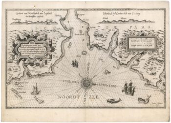
The First State of Waghenaer’s sea chart of south east Scotland
£3,500WAGHENAER, Lucas Janzoon.
Published In 1585
Stock No. 21772 -

An early 17th century map of Scotland
£450QUAD, Matthias.
Published In 1608
Stock No. 22372 -

19th century map of Scotland with decorative vignettes
£280TALLIS, John.
Published In 1851
Stock No. 23492 -

An 18th century miniature map of Scotland
£275Anonymous.
Published In 1752
Stock No. 22964