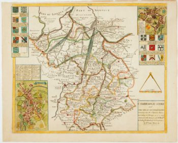
An early 19th century circular map of the environs of Cambridge
£400
In stock
A detailed map of the environs of Cambridge, drawn by Richardson and engraved by brothers George and John Cary.
The colour is particularly fine.
Additional information
| Dimensions | 480 × 475 mm |
|---|---|
| Cartographer | |
| Date | 1828 |
| Extra Info | |
| Publication | Cambridge: A. Watford, 1828. Fine original colour. Dissected and laid on linen as issued, total 475 x 480mm, folded into its original marbled slipcase, with publisher's title label. |
| Condition | A good example. |
| References | – |
Related Items
Related products
-

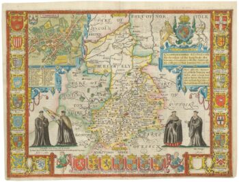
A rare issue of Speed’s map of Cambridgeshire
£2,200SPEED, John.
Published In 1665
Stock No. 24020 -

Uncommon map of Cambridgeshire from a Saxton county atlas
£1,250WILLDEY, George.
Published In 1749
Stock No. 15847 -

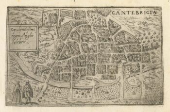
A 16th century Italian plan of Cambridge
£500VALEGIO, Francesco.
Published In 1598
Stock No. 24132 -

Miniature map of Hertfordshire, Bedfordshire and Cambridgeshire
£75PERROT, Aristide Michel.
Published In 1828
Stock No. 23136