A carte à figure map of Bohemia
£1,500
Out of stock
A fine map of Bohemia, from Speed's 'Prospect of the.. World'. At the top of this map are seven insets, showing views of Prague, Comethau (Chomutov), Schlani (Slany), Lavn (Louny), Polm (Polna) and Czalsa, and of the 'Corte of the Emparer'. On the left and right sides are illustrations of Bohemians of five social ranks, from Queen to Countryman. Shown on the map are all the major settlements of Bohemia, and those belonging to neighbouring Germany, Moravia Silesia and Austria, stretching from Chemnitz to Silberberg (Zlotoryja) in the north, and from Munchen (Munich) to Wien (Vienna) in the south.
Additional information
| Cartographer | |
|---|---|
| Date | 1676 |
| Extra Info | Bohemia. |
| Publication | London, Bassett & Chiswell, 1676. Coloured. 410 x 515mm. |
| Condition | A good example. |
| References | – |
Related Items
Related products
-

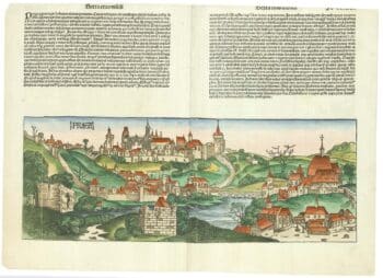
An incunable prospect of Prague
£1,450SCHEDEL, D. Hartmann.
Published In 1493
Stock No. 24451 -

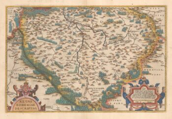
16th century Dutch map of Bohemia
£400ORTELIUS, Abraham.
Published In 1584
Stock No. 23874 -

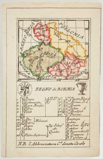
An 18th century playing-card map of Bohemia
£180RABATTA, Augusto & BAILOU, Jean Baptist de.
Published In 1779
Stock No. 12993 -

18th century map of Bohemia
£150SEUTTER, Matthaus.
Published In 1760
Stock No. 14746