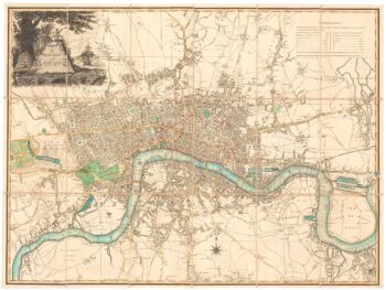
A 19th century map of London during the time of the Romans
£150
Out of stock
Add to WishlistRemove from Wishlist
Add to Wishlist
Striking white-on-black map of London as it was in the Roman period. Published in 1832 as part of 'The Guide to Knowledge' edited by Mr W. Pinnock.
Additional information
| Dimensions | 195 × 270 mm |
|---|---|
| Cartographer | |
| Date | 1832 |
| Extra Info | Londinium Augusta. |
| Publication | London, The Guide to Knowledge, 1832. 270 x 195mm. |
| Condition | A good example. |
| References | – |
Related Items
Related products
-

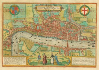
The first available printed map of London
£8,500BRAUN, Georg & HOGENBERG, Frans.
Published In 1579
Stock No. 18303 -

An unrecorded state of an early 19th century plan of London
£1,900LAURIE & WHITTLE.
Published In 1800
Stock No. 23944 -

A Victorian plan of London
£1,200PAYNE, Albert Henry.
Published In 1846
Stock No. 15892 -

Early Italian plan of London
£350VALEGIO, Francesco.
Published In 1713
Stock No. 18640