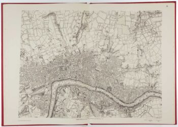
Mid-Victorian map of London with vignettes
£700
In stock
A decorative folding map of London with vignettes of the Tower of London from London Bridge and London from Holloway, with lengths of bridges shown and with elevations of principal buildings along the bottom margin. Unusual to find this map sold sparately in a booklet format as this example, it is normally found bound in the SDUK as part of the atlas volume.
Additional information
| Dimensions | 650 × 400 mm |
|---|---|
| Cartographer | |
| Date | 1836 |
| Extra Info | London. |
| Publication | London: Baldwin & Cradock, 1836. Original colour. Dissected and laid on linen, total 400 x 650mm, folded into original covers. |
| Condition | A good example. |
| References | – |
Related Items
Related products
-

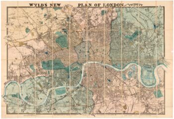
Large scale town plan of Victorian London
£1,000WYLD, James.
Published In 1869
Stock No. 24117 -

A colourful map of the history of London
£650BULLOCK, George Leslie.
Published In 1970
Stock No. 20617 -

Map of London at the beginning of the 18th century
£400FER, Nicolas de.
Published In 1705
Stock No. 23204 -

Facsimile of Rocque’s 16-Sheet Map of London
£400ROCQUE, John.
Published In 1971
Stock No. 15133