Cook’s map of the Society Islands
£150
Out of stock
Cook's map of the Society Islands. After observing the passage of Venus across the Sun in 1769, Cook sailed north, mapping these islands in the north part of the Society Islands (now part of French Polynesia).
Engraved by J.Cheevers for Hawkesworth's important work 'An account of the voyages undertaken by the order of His present Majesty for making discoveries in the Southern Hemisphere'', the official account of Cook's First Voyage.
Additional information
| Cartographer | |
|---|---|
| Date | 1773 |
| Extra Info | Chart of the Society Isles, discovered by by Lieut. J.Cook, 1769. |
| Publication | London, c.1773. Coloured. 320 x 470mm. |
| Condition | A good example. |
| References | – |
Related Items
Related products
-

Raiatea Island from Cook’s Voyages
£220HAWKESWORTH, John.
Published In 1773
Stock No. 13815 -

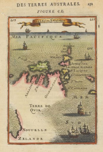
17th century map of the Solomon Islands, with part of New Zealand
£160MALLET, Alain Manesson.
Published In 1683
Stock No. 19097 -

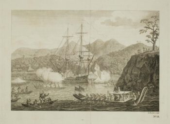
The Tahitians attack the ‘Dolphin’
£160ROOKER, E.
Published In 1773
Stock No. 13809 -

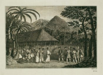
Samuel Wallis meets Oberea, the female chieftain of Tahiti
£90HAWKESWORTH, John.
Published In 1773
Stock No. 13808