- Reset all
- Abruzzo
- Adriatic Sea
- Andalusia
- Argentina
- Austria
- Balearics
- Belgium
- Black Sea
- Books about Maps
- British Isles
- Burma
- Calabria
- Campania
- Central America
- Central Asia Maps
- China
- Constantinople
- Cornwall
- Europe
- Far East
- France
- Gibraltar
- Greece
- Hispaniola
- Hungary
- Italy
- Jerusalem
- Latvia and Estonia
- London Environs
- Maritime
- Mediterranean Sea
- Monaco
- Moon
- Munster
- Near East
- North Africa Maps
- North America
- Pacific and Australasia
- Panama
- Paris
- Prospects
- Provence
- Russia
- Scandinavia
- Scientific Instruments
- Shropshire
- Somerset
- Southern Italy
- Spain
- St Helena
- St Kitts
- Syria
- Turkey
- Virgin Islands
- Warwickshire
- Worcestershire
- Zodiac
Showing 1681–1692 of 1755 results
-

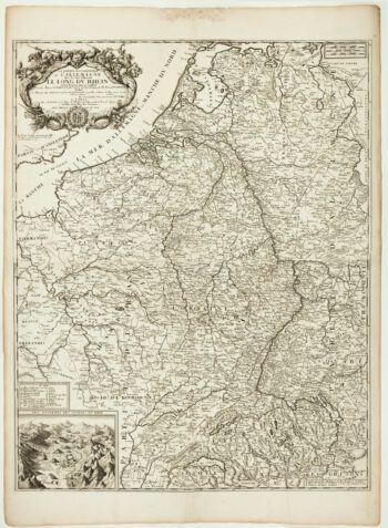
A scarce two-sheet map of the Rhine Region during the Nine Years’ War
£650NOLIN, Jean Baptiste.
Published In 1690
Stock No. 11393 -

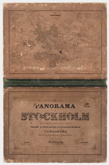
A true panorama of Stockholm
£1,200BILLMARK, C.J.
Published In 1850
Stock No. 10136 -

A romantic view of Venice by moonlight
£475BEEGER, Max & CHARPENTIER, A.
Published In 1850
Stock No. 10104 -

Campeche
£50ALLARD, Carel.
Published In 1720
Stock No. 9995 -

France
£340AA, Pieter van der.
Published In 1715
Stock No. 9943 -

Early 18th century view of Paris
£580AA, Pieter van der.
Published In 1715
Stock No. 9942 -

Early townplan of Sluis in Belgium
£220BRAUN, Georg & HOGENBERG, Frans.
Published In 1581
Stock No. 9914 -

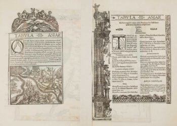
Ptolemaic map of the Caucasus
£700WALDSEEMULLER, Martin.
Published In 1535
Stock No. 9883 -

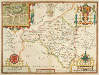
Speed’s county map of Radnor
£280SPEED, John.
Published In 1676
Stock No. 9874 -

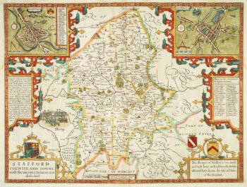
Staffordshire
£620SPEED, John.
Published In 1676
Stock No. 9870 -
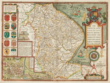
17th century English map of Lincolnshire
£800SPEED, John.
Published In 1676
Stock No. 9869 -

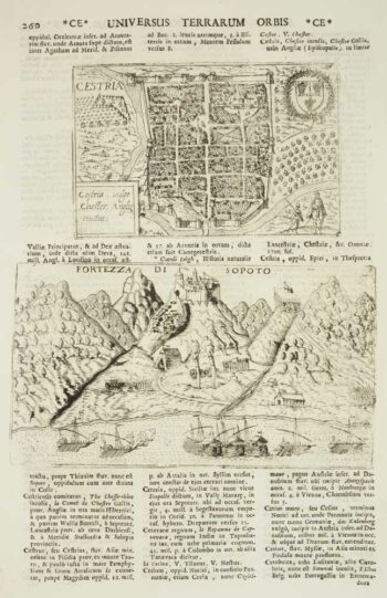
Chester
£50VALEGIO, Francesco & ROSACCIO, Guiseppe.
Published In 1713
Stock No. 9797