- Reset all
- Abruzzo
- Adriatic Sea
- Atlases
- Balearics
- Black Sea
- Books about Maps
- British Isles
- British Isles Maps
- Calabria
- Campania
- Canary Islands
- Central America
- China
- Constantinople
- Cornwall
- Corsica
- Dorset
- Europe
- Gibraltar
- Greece
- Hispaniola
- Hungary
- Indochina
- Lombardy
- London Environs
- Maritime
- Monaco
- Moon
- Near East
- North Africa Maps
- North America
- Norway
- Pacific and Australasia
- Panama
- Paris
- Prospects
- Provence
- Russia
- Shropshire
- Somerset
- South America
- Southern Italy
- Spain
- St Helena
- Staffordshire
- Syria
- Turkey
- Virgin Islands
- Warwickshire
- Worcestershire
- Zodiac
Showing 1633–1644 of 1721 results
-

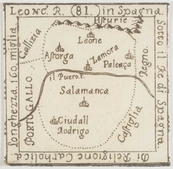
An extremely rare miniature map of Leon
£350FRESCHOT, Casimir Don.
Published In 1680
Stock No. 11161 -

18th century map of Finland
£400SEUTTER, Matthaus.
Published In 1730
Stock No. 11101 -

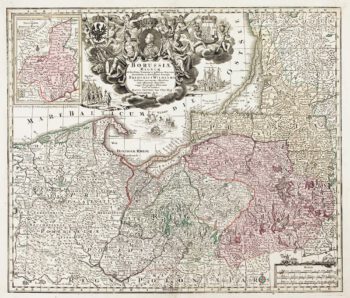
Detailed map of Prussia
£390SEUTTER, Matthaus.
Published In 1730
Stock No. 10985 -

A manuscript design for the new pier at Genoa
£500Anonymous.
Published In 1715
Stock No. 10882 -

Catalonia
£125BODENEHR, Gabriel.
Published In 1704
Stock No. 10878 -

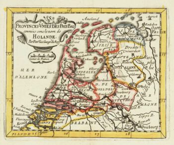
Miniature map of Holland
£140DU VAL, Pierre.
Published In 1682
Stock No. 10859 -

Miniature map of Guiana
£125DU VAL, Pierre.
Published In 1682
Stock No. 10856 -

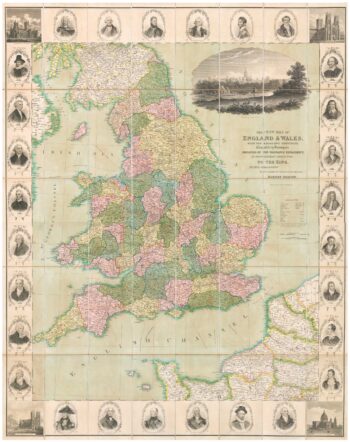
A decorative wall map of England & Wales
£1,500SEATON, Robert.
Published In 1835
Stock No. 10838 -
Miniature map of Peru
£80DU VAL, Pierre.
Published In 1682
Stock No. 10824 -

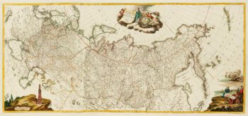
An impressive three-sheet map of the Russian Empire
£2,950TRESCOTT, John & SCHMIDT, Jakob.
Published In 1782
Stock No. 10643 -

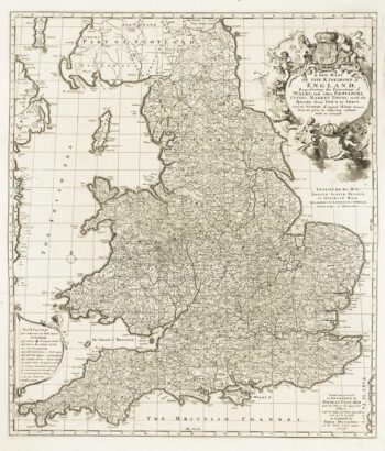
Four-sheet folding map of England & Wales
£800CREIGHTON, R.
Published In 1839
Stock No. 10621 -

An Anglo-Dutch separate-issue road map of England
£480VISSCHER, Nicolas.
Published In 1694
Stock No. 10557