- Reset all
- Abruzzo
- Adriatic Sea
- Atlases
- Balearics
- Black Sea
- Books about Maps
- British Isles
- Calabria
- Campania
- Canary Islands
- Central America
- China
- Constantinople
- Cornwall
- Dorset
- Europe
- Gibraltar
- Greece
- Herefordshire
- Hispaniola
- Hungary
- Italy
- London Environs
- Maritime
- Monaco
- Moon
- Near East
- North Africa Maps
- North America
- Norway
- Pacific and Australasia
- Panama
- Paris
- Prospects
- Provence
- Russia
- Scientific Instruments
- Shropshire
- Somerset
- Southern Italy
- Spain
- St Helena
- Staffordshire
- Syria
- Turkey
- United States
- Virgin Islands
- Warwickshire
- Worcestershire
- Zodiac
Showing 13–24 of 1631 results
-

de Hooghe’s spectacular chart of the Mediterranean Sea
£36,500HOOGHE, Romeyn de.
Published In 1694
Stock No. 24488 -

A view of the Battle of Lepanto engraved in 1572
£2,500CAVALIERI, Giovanni Battista de'.
Published In 1647
Stock No. 24486 -

A monumental sea chart of south-west England
£3,250HOOGHE, Romeyn de.
Published In 1693
Stock No. 24483 -

Uncommon 16th century Italian map of Cyprus
£1,600ROSACCIO, Giuseppe.
Published In 1598
Stock No. 24538 -

A rare lifetime printing of Blaeu’s view of Vesuvius erupting in 1631
£1,400BLAEU, Johannes.
Published In 1663
Stock No. 24506 -

A rare wall map of the Holy Land
£9,000NOLIN, Jean Baptiste.
Published In 1785
Stock No. 24500 -

A monumental 18th century wall map of Switzerland on four sheets
£6,500SCHEUCHZER, Johann Jakob.
Published In 1712
Stock No. 24499 -

London by one of England’s foremost maritime artists
£7,000WYLLIE, William Lionel.
Published In 1884
Stock No. 24497 -

A very fine early 19th century miniature atlas
£2,250REMONDINI, Giuseppe Antonio.
Published In 1801
Stock No. 24527 -

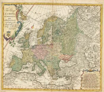
18th century map of Europe
£440EULER, Leonhard.
Published In 1760
Stock No. 24111 -

An instructional card explaining shipboard directions
£220Anonymous.
Published In 1840
Stock No. 24472 -

An advert for an American railway
£750Anonymous.
Published In 1865
Stock No. 24455