- Reset all
- Abruzzo
- Aegean Islands
- Africa Continent
- America
- Bering Strait
- Bermuda
- Black Sea
- Books about Maps
- Calabria
- Campania
- Central America
- China
- Emilia Romagna
- Europe
- Hispaniola
- Hungary
- Iceland
- India
- Ireland
- Isle of Wight
- Italy
- Lancashire
- Leicestershire
- London Environs
- Maritime
- Mexico
- Monaco
- North Africa Maps
- North America
- Oxfordshire
- Pacific and Australasia
- Pennsylvania
- Poland
- Portugal
- Prints
- Provence
- Russia
- Scientific Illustrations
- Scientific Instruments
- Somerset
- Southern Italy
- Spain
- Surrey
- Sussex
- Syria
- United States Maps
- Worcestershire
Showing 1465–1476 of 1543 results
-

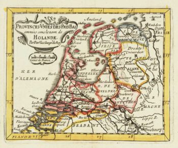
Miniature map of Holland
£140DU VAL, Pierre.
Published In 1682
Stock No. 10859 -

Miniature map of Guiana
£125DU VAL, Pierre.
Published In 1682
Stock No. 10856 -

Miniature map of Peru
£80DU VAL, Pierre.
Published In 1682
Stock No. 10824 -

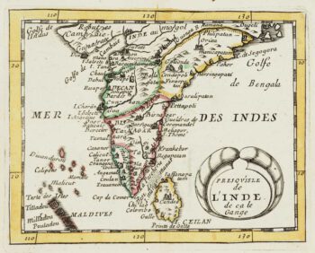
Miniature map of India
£200DU VAL, Pierre.
Published In 1682
Stock No. 10809 -

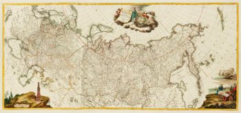
An impressive three-sheet map of the Russian Empire
£2,950TRESCOTT, John & SCHMIDT, Jakob.
Published In 1782
Stock No. 10643 -

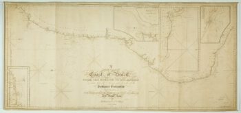
A large and detailed chart of the Bahamas
£650BELLIN, Jacques-Nicolas.
Published In 1768
Stock No. 10641 -

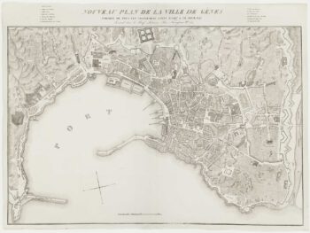
A fine town-plan of Genoa
£450ZUCOLI, Léon.
Published In 1849
Stock No. 10532 -

A pictorial map of the Baltic theatre of the Crimean War
£325ILLUSTRATED LONDON NEWS.
Published In 1856
Stock No. 10369 -
A detailed American ‘blue-back’ sea chart of the Brazilian coastline
£1,200BLUNT, E. & G.W.
Published In 1840
Stock No. 10336 -

The Maritime Alps
£450CORONELLI, Vincenzo Maria.
Published In 1690
Stock No. 10278 -

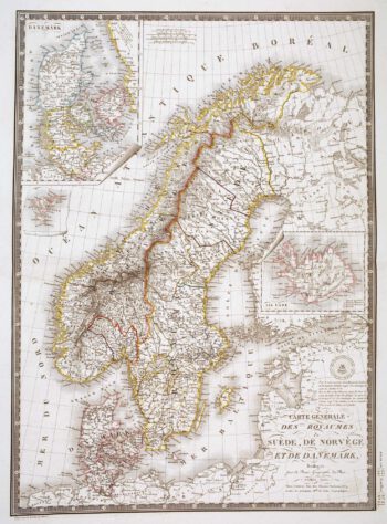
Detailed 19th century map of Scandinavia
£160BRUÉ, Adrien Hubert.
Published In 1825
Stock No. 10277 -

Blaeu’s famous plan of Frankfurt in original colours
£950BLAEU, Johannes.
Published In 1640
Stock No. 10159