- Reset all
- Abruzzo
- Aegean Islands
- Africa Continent
- Bering Strait
- Bermuda
- Black Sea
- Books about Maps
- Calabria
- Campania
- Canada
- Central America
- China
- Emilia Romagna
- Europe
- Hispaniola
- Hungary
- Iceland
- India
- Ireland
- Isle of Wight
- Leicestershire
- Leinster
- London Environs
- Marche
- Maritime
- Mexico
- Monaco
- Near East
- North Africa Maps
- North America
- Oxfordshire
- Pacific and Australasia
- Pennsylvania
- Poland
- Portugal
- Prints
- Provence
- Russia
- Sardinia
- Scientific Instruments
- Somerset
- Southern Italy
- Spain
- Surrey
- Syria
- Ukraine
- United States Maps
- Veneto
- Worcestershire
Showing 1357–1368 of 1460 results
-

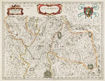
17th century map of Cadore
£200BLAEU, Johannes.
Published In 1640
Stock No. 12068 -

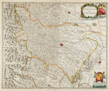
17th century map of Emilia Romagna
£225BLAEU, Johannes.
Published In 1640
Stock No. 12048 -

Early 17th century map of the Turkish Empire
£300HONDIUS, Jodocus.
Published In 1607
Stock No. 11990 -

17th century map of China
£1,200LOON, Jan van.
Published In 1690
Stock No. 11964 -

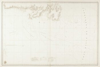
A scarce Spanish two-sheet sea chart of Newfoundland
£1,200MORENO, Miguel.
Published In 1860
Stock No. 11852 -

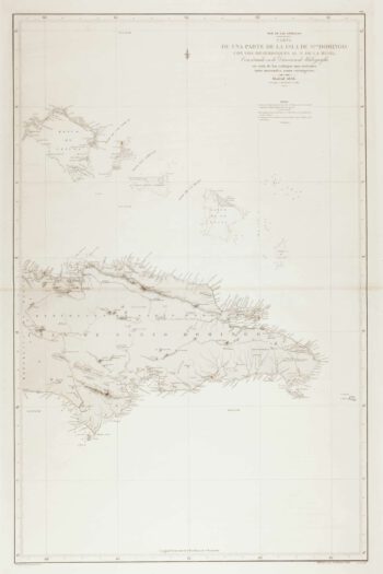
An uncommon 19th century Spanish sea chart of the Dominican Republic
£100MOUCHEZ, Amédée Ernest Barthémy.
Published In 1865
Stock No. 11846 -

An uncommon 19th century Spanish sea chart of the Dominican Republic & the Turks and Caicos Islands
£550BREGANTE, F.
Published In 1867
Stock No. 11838 -

An uncommon 19th century old sea chart of western India
£750DIRECCION HIDROGRAFICA DE MADRID.
Published In 1870
Stock No. 12284 -

An uncommon 19th century Spanish sea chart of south west India with Lakshadweep
£650DIRECCION HIDROGRAFICA DE MADRID.
Published In 1870
Stock No. 12283 -

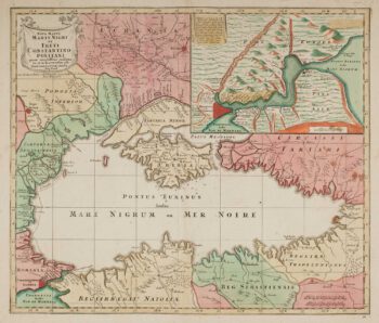
Map of the Black Sea in original colour
£580LOTTER, Tobias Conrad.
Published In 1760
Stock No. 12175 -

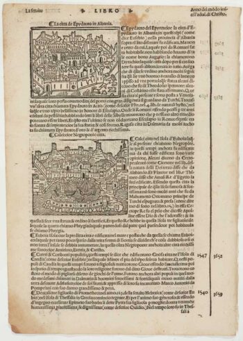
Early 16th century prospect of Athens
£120FORESTI, Giacomo.
Published In 1503
Stock No. 12059 -

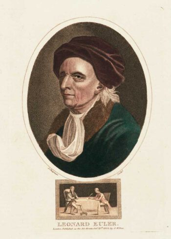
A colour-printed stipple portrait of Leonhard Euler
£220CHAPMAN, J.
Published In 1804
Stock No. 11809