- Reset all
- Abruzzo
- Afghanistan
- Africa Continent
- Bering Strait
- Black Sea
- Bolivia
- Books about Maps
- Bristol
- Calabria
- Campania
- Central Asia Maps
- China
- Emilia Romagna
- Europe
- Far East
- Grenada
- Hispaniola
- Hungary
- Iceland
- Ischia
- Italy
- Kent
- Lincolnshire
- London Environs
- Maritime
- Martinique
- North America
- Oxfordshire
- Pacific and Australasia
- Pennsylvania
- Pictorial Maps
- Piedmont
- Poland
- Sardinia
- Scientific Instruments
- Scotland Maps
- Somerset
- South America
- Southern Italy
- Syria
- Texas
- Tibet
- United States Maps
- West Coast
- Worcestershire
- Zodiac
Showing 1369–1380 of 1471 results
-

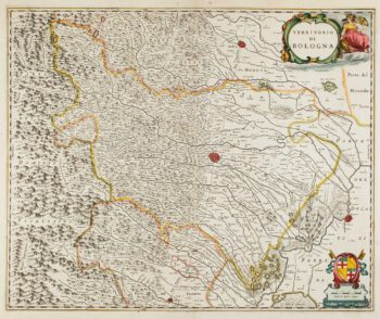
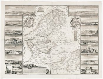
17th century map of Emilia Romagna
£225BLAEU, Johannes.
Published In 1640
Stock No. 12048 -

17th century map of China
£1,200LOON, Jan van.
Published In 1690
Stock No. 11964 -

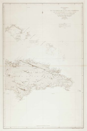
An uncommon 19th century Spanish sea chart of the Dominican Republic
£100MOUCHEZ, Amédée Ernest Barthémy.
Published In 1865
Stock No. 11846 -

An uncommon 19th century Spanish sea chart of the Dominican Republic & the Turks and Caicos Islands
£550BREGANTE, F.
Published In 1867
Stock No. 11838 -

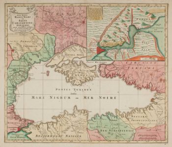
Map of the Black Sea in original colour
£580LOTTER, Tobias Conrad.
Published In 1760
Stock No. 12175 -

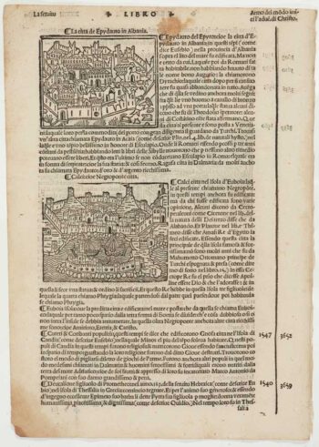
Early 16th century prospect of Athens
£120FORESTI, Giacomo.
Published In 1503
Stock No. 12059 -

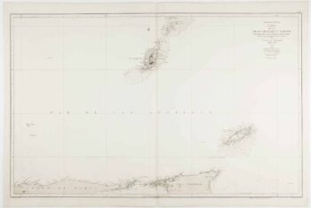
An uncommon 19th century Spanish sea chart of Grenada and Tobago
£800BREGANTE, S.
Published In 1868
Stock No. 11824 -

A decorative four-sheet map of France in fine colour
£2,000INSELIN, Charles.
Published In 1713
Stock No. 11666 -

Scarce four-sheet map of the Community of Madrid
£5,000LEONARDO, Juan Francisco.
Published In 1687
Stock No. 11652 -

A scarce bird’s-eye view of Paris
£1,200Anonymous.
Published In 1680
Stock No. 11573 -

Russia at the beginning of the reign of Peter the Great
£825DU VAL, Pierre.
Published In 1686
Stock No. 11447 -

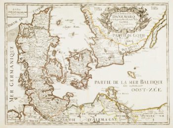
17th century French map of Denmark
£200DU VAL, Pierre.
Published In 1686
Stock No. 11443