No products in the cart.
- Reset all
- Abruzzo
- Afghanistan
- Arctic
- Austria
- Bahamas
- Barbary Coast
- Beijing
- Belgium
- Benelux
- Black Sea
- Books about Maps
- British Isles Maps
- Calabria
- Campania
- Central America
- Central Asia Maps
- Central Italy
- China
- Constantinople
- Constellations
- Devon
- Eastern Seaboard Maps
- Elba
- England and Wales
- Europe
- Gloucestershire
- Greece
- Grenada
- Hampshire
- Hispaniola
- Hong Kong
- Hungary
- Italy
- Japan
- Lazio
- Lincolnshire
- Lombardy
- London Environs
- Maritime
- Mexico
- Middlesex
- Moon
- Near East
- North America
- Pacific and Australasia
- Polar
- Provence
- Sardinia
- Scientific Instruments
- Scotland
- Seychelles
- Somerset
- South America
- Southern Italy
- Suffolk
- Syria
- Trentino
- Virginia
- Westmorland
- Worcestershire
- Zodiac
Showing 1513–1524 of 1555 results
-

Large and detailed 18th century map of Sardinia
£750SEUTTER, Matthaus.
Published In 1730
Stock No. 9318 -

18th century town plan of Nienburg
£350SEUTTER, Matthaus.
Published In 1741
Stock No. 9316 -

18th century map of Japan
£500SANTINI, Francesco & Paolo.
Published In 1778
Stock No. 9315 -

Chart of St Paul’s Bay, Malta
£490SMYTH, William Henry.
Published In 1855
Stock No. 9183 -

Miniature map of Sardinia
£155ORTELIUS, Abraham.
Published In 1602
Stock No. 9144 -

Miniature map of Corsica
£125ORTELIUS, Abraham.
Published In 1602
Stock No. 9121 -

An 18th century chart of Corfu
£95ROUX, Joseph.
Published In 1764
Stock No. 9108 -

Holland
£400QUAD, Matthias.
Published In 1600
Stock No. 9094 -

Miniature map of Andalusia
£60ORTELIUS, Abraham.
Published In 1598
Stock No. 9054 -

Plan of Toulon in the mid-19th century
£75Society for the Diffusion of Useful Knowledge.
Published In 1836
Stock No. 9047 -

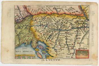
Miniature map of Dalmatia
£120ORTELIUS, Abraham.
Published In 1655
Stock No. 9016 -

Incunable prospect of Pisa
£400SCHEDEL, D. Hartmann.
Published In 1493
Stock No. 8951