- Reset all
- Abruzzo
- Africa Continent
- Bering Strait
- Black Sea
- Books about Maps
- Bristol
- Calabria
- Campania
- Central Asia Maps
- China
- Connaught
- Emilia Romagna
- Europe
- Grenada
- Hispaniola
- Hungary
- Italy
- Kent
- Lancashire
- London Environs
- London Maps
- Maritime
- Martinique
- Monaco
- North America
- Oxfordshire
- Pacific and Australasia
- Pennsylvania
- Pictorial Maps
- Poland
- Provence
- Scientific Instruments
- Somerset
- South America
- Southern Italy
- Syria
- Texas
- Ukraine
- United States Maps
- Worcestershire
Showing 1321–1332 of 1335 results
-

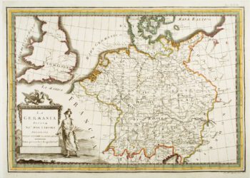
18th century map of Germany
£190CASSINI, Giovanni Maria.
Published In 1795
Stock No. 7787 -

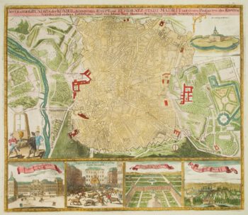
Detailed town plan of Madrid
£900HOMANN, Johann Baptist.
Published In 1710
Stock No. 7710 -

Denmark Jutland
£225DE WIT, Frederick.
Published In 1688
Stock No. 7706 -

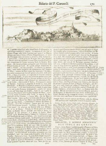
Corfu City
£120CORONELLI, Vincenzo Maria.
Published In 1696
Stock No. 7629 -

An uncommon sea chart of France’s Mediterranean coast
£300LEVANTO, Francesco Maria.
Published In 1696
Stock No. 7408 -

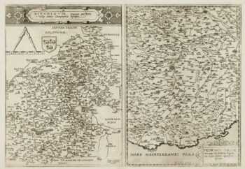
A scarce 16th century map of Piedmont and Berry
£1,100DE JODE, Gerard.
Published In 1593
Stock No. 7395 -

Rare map of the Bering Strait
£350CASSINI, Giovanni Maria.
Published In 1798
Stock No. 7375 -

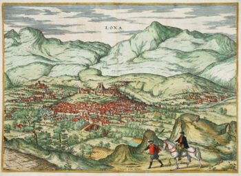
Early prospect of Loja
£325BRAUN, Georg & HOGENBERG, Frans.
Published In 1575
Stock No. 7340 -

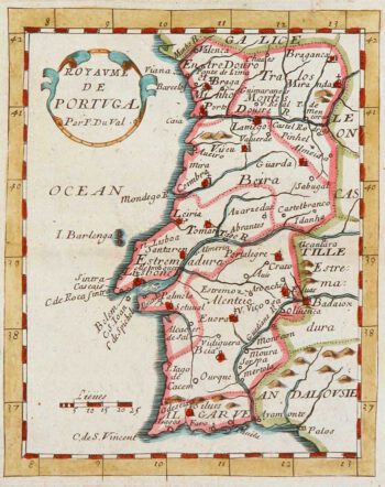
Miniature map of Portugal
£100DU VAL, Pierre.
Published In 1680
Stock No. 8134 -

17th century map of Portugal
£300DE WIT, Frederick.
Published In 1688
Stock No. 7672 -

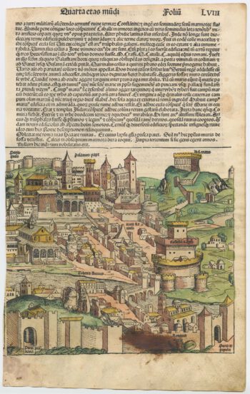
An incunable prospect of Genoa in rare contemporary colour
£950SCHEDEL, D. Hartmann.
Published In 1493
Stock No. 23035 -

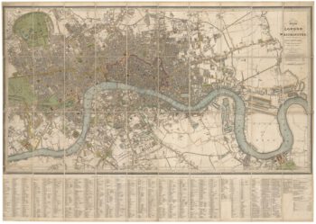
Detailed plan of London under William IV
£3,000FADEN, William.
Published In 1830
Stock No. 22893