- Reset all
- Abruzzo
- Africa Continent
- Bering Strait
- Black Sea
- Books about Maps
- Calabria
- Campania
- China
- Connaught
- Emilia Romagna
- Hispaniola
- Hungary
- Ireland
- Leicestershire
- London Environs
- Maritime
- Monaco
- Near East
- North America
- Northern Europe
- Oxfordshire
- Pacific and Australasia
- Pennsylvania
- Poland
- Prints
- Provence
- Russia
- Scientific Instruments
- Serio-Comic
- Somerset
- Southern Italy
- Syria
- United States Maps
- Worcestershire
- Zodiac
Showing 13–24 of 672 results
-

An 18th century map of North America
£1,200WEIGEL, Christoph.
Published In 1718
Stock No. 24541 -

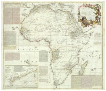
An 18th century wall map of Africa
£2,000ANVILLE, Jean Baptiste B. D'.
Published In 1772
Stock No. 24498 -

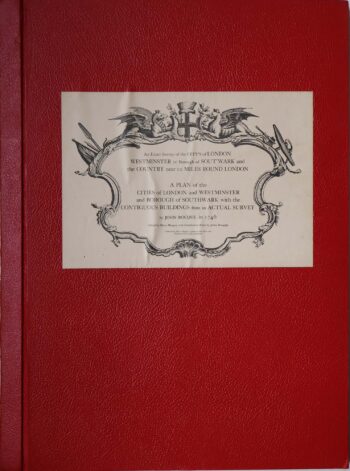
Facsimile of both Rocque’s 24 & 16-sheet map of London
£650ROCQUE, John.
Published In 1971
Stock No. 24478 -

16th century map of the Kingdom of Naples
£650ORTELIUS, Abraham.
Published In 1595
Stock No. 24444 -

Four scarce Italian playing cards depicting Norway
£850Anonymous.
Published In 1790
Stock No. 24246 -

Four scarce Italian playing cards depicting Poland
£850Anonymous.
Published In 1790
Stock No. 24241 -

A scarce 17th century prospect of Villefranche-sur-Mer
£1,500BLAEU, Johannes.
Published In 1682
Stock No. 24159 -

A 16th century Italian plan of Buda
£600VALEGIO, Francesco.
Published In 1598
Stock No. 24150 -

A mid-18th century map of North America
£850LOTTER, Tobias Conrad.
Published In 1765
Stock No. 24610 -

A late-Georgian map of the environs of London
£650CRUCHLEY, George Frederick.
Published In 1827
Stock No. 15495 -

16th century woodblock map of Silesia
£300MUNSTER, Sebastian.
Published In 1572
Stock No. 24582 -

The building of the Uptown Hudson Tubes in New York
£450Anonymous.
Published In 1890
Stock No. 24556