Showing 1–12 of 735 results
-

An unusual 18th century map of the Holy Land
£800SEUTTER, Matth?us.
Published In 1745
Stock No. 24605 -

Zatta’s important map showing Cook’s charting of New Zealand
£1,750ZATTA, Antonio.
Published In 1778
Stock No. 24601 -

A plan of Jerusalem after Adrichom
£750SEUTTER, Matth?us.
Published In 1730
Stock No. 24600 -

Map of Australia and New Zealand after Cook’s First Voyage to the Pacific
£1,000ZATTA, Antonio.
Published In 1776
Stock No. 24599 -

An early woodcut map of the Holy Land
£850MUNSTER, Sebastian.
Published In 1552
Stock No. 24569 -

Munster’s classic woodcut map of Italy
£850MUNSTER, Sebastian.
Published In 1572
Stock No. 24562 -

The English edition of Du Halde’s map of Guangdong
£1,600DU HALDE, Johann Baptiste.
Published In 1738
Stock No. 24558 -

A classic 16th century Dutch map of Italy
£1,400ORTELIUS, Abraham.
Published In 1572
Stock No. 24552 -

17th century prospect of Biblical Jerusalem
£1,000DAPPER, Olfert.
Published In 1677
Stock No. 24540 -

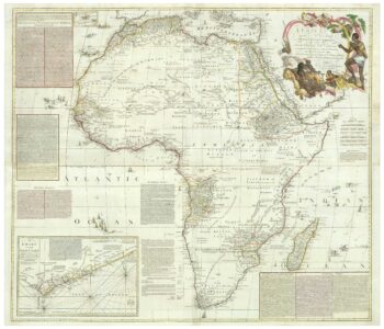
An 18th century wall map of Africa
£2,000ANVILLE, Jean Baptiste B. D'.
Published In 1772
Stock No. 24498 -

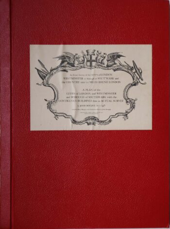
Facsimile of both Rocque’s 24 & 16-sheet map of London
£650ROCQUE, John.
Published In 1971
Stock No. 24478 -

16th century map of the Kingdom of Naples
£650ORTELIUS, Abraham.
Published In 1595
Stock No. 24444