- Reset all
- Abruzzo
- African Islands
- Australia
- Balearics
- Bolivia
- Burma
- Devon
- Far East Maps
- Gulf States
- Holy Land
- Ionian Islands
- Leinster
- London Maps
- Malta
- Map Collecting
- Map Games
- North America Maps
- Northamptonshire
- Old World
- Pennsylvania
- Polar
- Scottish Towns
- Solar System
- Southern Europe
- Suffolk
- Switzerland
Showing 697–708 of 778 results
-

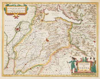
17th century map of the Province of Verona
£300JANSSON, Jan.
Published In 1636
Stock No. 14652 -

Two-sheet map of Sardinia in superb original colour
£880MORTIER, Pierre.
Published In 1705
Stock No. 14520 -

Mortier’s sea chart of Madagascar in full original colour
£1,100MORTIER, Pierre.
Published In 1700
Stock No. 14518 -

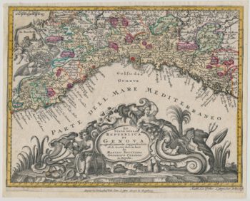
Decorative 18th century map of Liguria
£250SEUTTER, Matthaus.
Published In 1760
Stock No. 14512 -

A scarce Irish chart of the Western part of the Mediterranean
£2,000GRIERSON, George
Published In 1735
Stock No. 14456 -

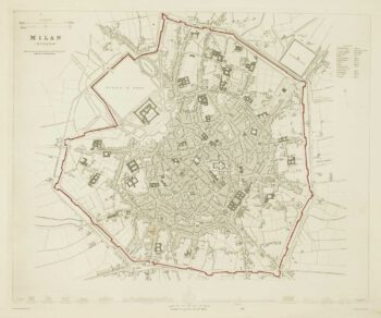
Detailed townplan of Milan
£130Society for the Diffusion of Useful Knowledge.
Published In 1862
Stock No. 14405 -

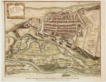
18th century plan of Cuneo
£240TINDAL & RAPIN.
Published In 1750
Stock No. 14332 -

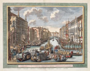
18th century view of the Venice Regatta
£600LOVISA, Domenico.
Published In 1717
Stock No. 14158 -
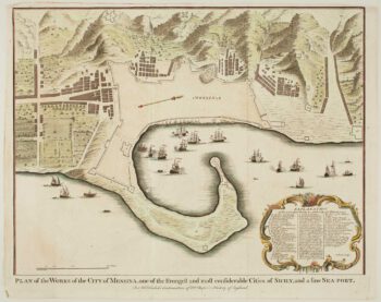
Town plan of Messina
£180BASIRE, Isaac.
Published In 1750
Stock No. 14147 -

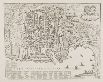
Town plan of Palermo
£550BLAEU, Johannes.
Published In 1705
Stock No. 14146 -

17th century map of Sicily
£900BLAEU, Willem Janszoon.
Published In 1640
Stock No. 13878 -

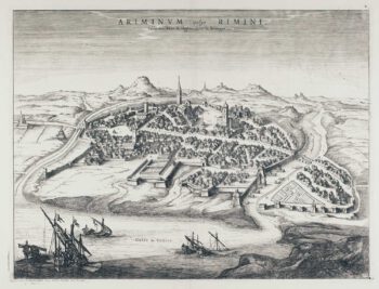
Prospect of Rimini after Hoefnagel
£650BLAEU, Johannes.
Published In 1704
Stock No. 13645