- Reset all
- Abruzzo
- Antarctic
- Azores
- Balkan maps
- Bering Strait
- Black Sea
- Books about Maps
- Calabria
- Campania
- China
- Emilia Romagna
- Guadeloupe
- Hispaniola
- Hungary
- Italy
- London Environs
- Maritime
- Monaco
- North America
- Oxfordshire
- Pacific and Australasia
- Pennsylvania
- Pictorial Maps
- Poland
- Polar
- Provence
- Scientific Instruments
- Scotland Maps
- Somerset
- Southern Italy
- Syria
- United States Maps
- West Indies Maps
- Worcestershire
- Zodiac
Showing 25–36 of 654 results
-

18th century map of China
£320TIRION, Isaak.
Published In 1740
Stock No. 24547 -

John Oxley’s mapping of New South Wales
£280HALL, Sidney.
Published In 1828
Stock No. 24519 -

Seven scarce Italian playing cards depicting the Balkans and Greece
£480Anonymous.
Published In 1790
Stock No. 24361 -

Chart of the Zodiac sign Cancer
£275BLUNT, Charles F.
Published In 1845
Stock No. 24288 -

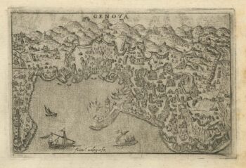
A 16th century town plan of Genova
£250VALEGIO, Francesco.
Published In 1598
Stock No. 24198 -

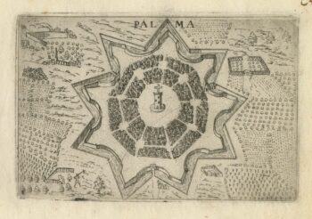
A 16th century town plan of Palmanova
£180VALEGIO, Francesco.
Published In 1598
Stock No. 24197 -

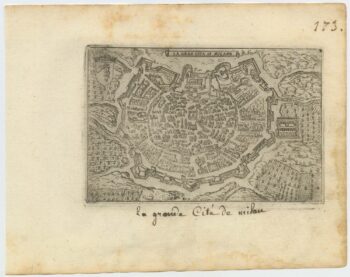
A 16th century town plan of Milan
£240VALEGIO, Francesco.
Published In 1598
Stock No. 24196 -

A 16th century town plan of classical Rome
£140VALEGIO, Francesco.
Published In 1598
Stock No. 24195 -
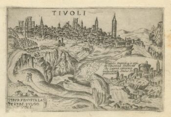
A 16th century town plan of Tivoli
£140VALEGIO, Francesco.
Published In 1598
Stock No. 24192 -

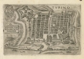
A 16th century town plan of Turin
£300VALEGIO, Francesco.
Published In 1598
Stock No. 24191 -

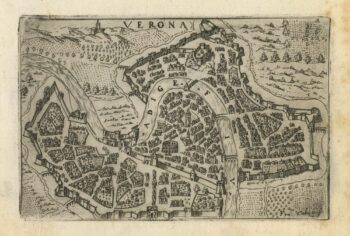
A 16th century town plan of Verona
£300VALEGIO, Francesco.
Published In 1598
Stock No. 24190 -

A 16th century town plan of Dubrovnik
£250VALEGIO, Francesco.
Published In 1598
Stock No. 24175