- Reset all
- Abruzzo
- Arctic
- Austria
- Barbary Coast
- Beijing
- Benelux
- Black Sea
- Books about Maps
- British Isles Maps
- Calabria
- Campania
- Central America
- Central Italy
- China
- Constantinople
- Constellations
- Europe
- Gloucestershire
- Grenada
- Hispaniola
- Hungary
- Italy
- London Environs
- Maritime
- Middlesex
- Monaco
- Moon
- Near East
- North America
- Pacific and Australasia
- Polar
- Provence
- Sardinia
- Scientific Instruments
- Somerset
- Southern Italy
- Syria
- Trentino
- Turkey
- Virginia
- Westmorland
- Worcestershire
- World
- Zodiac
Showing 13–24 of 1377 results
-

A rare wall map of the Holy Land
£9,000NOLIN, Jean Baptiste.
Published In 1785
Stock No. 24500 -

A monumental 18th century wall map of Switzerland on four sheets
£6,500SCHEUCHZER, Johann Jakob.
Published In 1712
Stock No. 24499 -

One of the earliest world maps available to the collector
£15,000SCHEDEL, D. Hartmann.
Published In 1493
Stock No. 24528 -

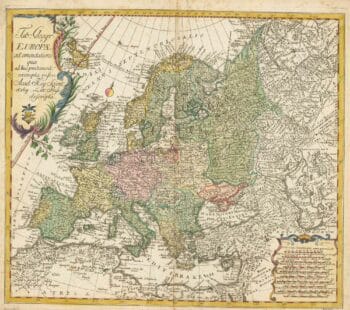
18th century map of Europe
£440EULER, Leonhard.
Published In 1760
Stock No. 24111 -

An instructional card explaining shipboard directions
£220Anonymous.
Published In 1840
Stock No. 24472 -

An incunable prospect of Prague
£1,450SCHEDEL, D. Hartmann.
Published In 1493
Stock No. 24451 -

London in the reign of William IV
£550SMITH, Charles.
Published In 1836
Stock No. 24428 -

An incunable prospect of Jerusalem
£1,600SCHEDEL, D. Hartmann.
Published In 1493
Stock No. 24425 -

A two-sheet map of North America
£2,950JAILLOT, Alexis-Hubert.
Published In 1705
Stock No. 24062 -

Russia, from the first English atlas of the World
£2,200SPEED, John.
Published In 1676
Stock No. 23731 -
Victorian map of China with views of Hong Kong and Canton
£250TALLIS, John.
Published In 1851
Stock No. 23537 -

A 16th century map of the colony of New Spain
£750ORTELIUS, Abraham.
Published In 1584
Stock No. 24448