- Reset all
- Abruzzo
- Arctic
- Azores
- Bering Strait
- Black Sea
- Calabria
- Campania
- China
- Emilia Romagna
- Europe
- Games
- Hispaniola
- Hungary
- Italy
- London Environs
- London Transport Maps
- Marche
- Maritime
- Monaco
- North America
- Oxfordshire
- Pacific and Australasia
- Pennsylvania
- Poland
- Polar
- Provence
- Scientific Instruments
- Scotland Maps
- Somerset
- Syria
- United States Maps
- Worcestershire
Showing 37–48 of 1173 results
-

18th century map of China
£320TIRION, Isaak.
Published In 1740
Stock No. 24547 -

John Oxley’s mapping of New South Wales
£280HALL, Sidney.
Published In 1828
Stock No. 24519 -

Seven scarce Italian playing cards depicting the Balkans and Greece
£480Anonymous.
Published In 1790
Stock No. 24361 -

Seven scarce Italian playing cards depicting Russia
£480Anonymous.
Published In 1790
Stock No. 24360 -

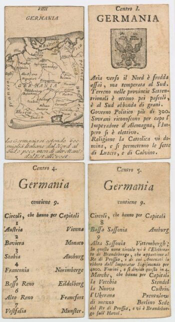
Four scarce Italian playing cards depicting Germany
£280Anonymous.
Published In 1790
Stock No. 24244 -

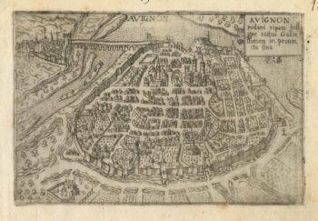
A 16th century town plan of Avignon
£150VALEGIO, Francesco.
Published In 1598
Stock No. 24211 -
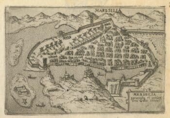
A 16th century town plan of Marseilles
£200VALEGIO, Francesco.
Published In 1598
Stock No. 24210 -

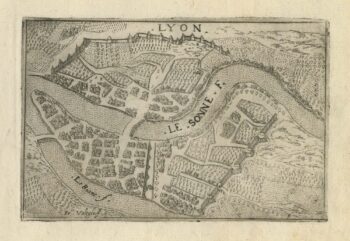
A 16th century town plan of Lyon
£150VALEGIO, Francesco.
Published In 1598
Stock No. 24209 -

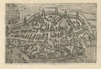
A 16th century town plan of Zurich
£380VALEGIO, Francesco.
Published In 1598
Stock No. 24208 -

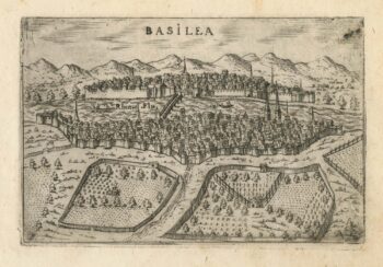
A 16th century town plan of Basle
£280VALEGIO, Francesco.
Published In 1598
Stock No. 24207 -

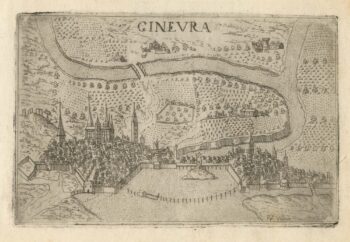
A 16th century town plan of Geneva
£220VALEGIO, Francesco.
Published In 1598
Stock No. 24206 -

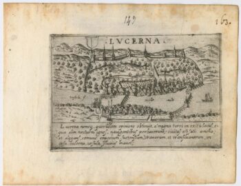
A 16th century town plan of Lucerne
£300VALEGIO, Francesco.
Published In 1598
Stock No. 24205