- Reset all
- Abruzzo
- Asia Continent
- Atlases
- Atlases and Books
- Australia
- Bahamas
- Balearics
- Books about Maps
- British Isles
- British Isles Maps
- Calabria
- California
- Campania
- Central America
- China
- Constantinople
- Constellations
- Cornwall
- Devon
- Dorset
- Europe
- Georgia
- Gibraltar
- Greece
- Hispaniola
- Hong Kong
- Hungary
- Ionian Islands
- Ischia
- Lazio
- Leicestershire
- Lombardy
- London Environs
- Maritime
- Monaco
- Moon
- Moscow
- Munster
- Near East
- North Africa Maps
- North America
- North Europe Maps
- Northamptonshire
- Norway
- Panama
- Paris
- Prospects
- Provence
- Scandinavia Maps
- Somerset
- Southern Italy
- Spain
- St Helena
- Syria
- Turkey
- Venezuela
- Vietnam
- Virginia
- Warwickshire
- Worcestershire
Showing 37–48 of 1710 results
-

16th century woodblock map of Silesia
£300MUNSTER, Sebastian.
Published In 1572
Stock No. 24582 -

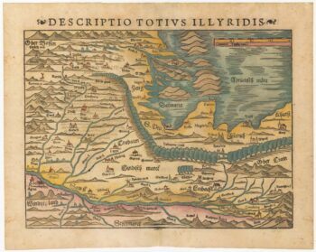
16th century woodblock map of Slovenia and Croatia
£375MUNSTER, Sebastian.
Published In 1572
Stock No. 24581 -

16th century woodblock map of France
£380MUNSTER, Sebastian.
Published In 1572
Stock No. 24580 -
Munster’s map of the Iberian Peninsula
£400MUNSTER, Sebastian.
Published In 1572
Stock No. 24579 -

A 16th century woodcut prospect of Rome
£400MUNSTER, Sebastian.
Published In 1572
Stock No. 24577 -
A 16th century woodcut map of Greece
£380MUNSTER, Sebastian.
Published In 1572
Stock No. 24576 -
A 16th century woodcut map of Classical Rome
£220MUNSTER, Sebastian.
Published In 1572
Stock No. 24572 -
A 16th century woodcut map of Switzerland
£400MUNSTER, Sebastian.
Published In 1572
Stock No. 24570 -
An early 18th century map of the Middle East
£450CHATELAIN, Henri Abraham.
Published In 1720
Stock No. 24551 -

18th century map of China
£320TIRION, Isaak.
Published In 1740
Stock No. 24547 -

A scarce map of the Holy Land in the 18th century
£250FER, Nicolas de.
Published In 1707
Stock No. 24525 -

A scarce map of the Holy Land in Biblical times
£250FER, Nicolas de.
Published In 1707
Stock No. 24524