- Reset all
- Abruzzo
- Azores
- Bering Strait
- Black Sea
- Calabria
- Campania
- China
- Emilia Romagna
- England and Wales
- Europe
- Games
- Hispaniola
- Hungary
- Italy
- London Environs
- Marche
- Maritime
- Monaco
- North America
- Oxfordshire
- Pacific and Australasia
- Pennsylvania
- Poland
- Polar
- Provence
- Scientific Instruments
- Scotland Maps
- Somerset
- Syria
- United States Maps
- Worcestershire
- Zodiac
Showing 1117–1128 of 1212 results
-

Sea chart of the East China Sea
£900BRYANT, Tomas.
Published In 1864
Stock No. 12452 -

Important French map of China by D’Anville
£900ANVILLE, Jean Baptiste B. D'.
Published In 1737
Stock No. 12227 -

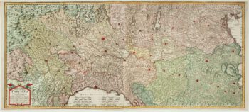
A two-sheet old map of the Po River
£1,300CERRUTI, Agostino.
Published In 1735
Stock No. 12221 -

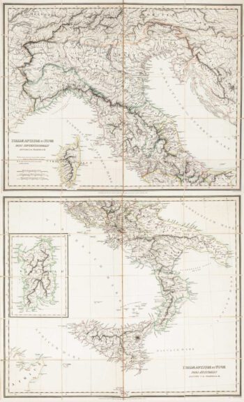
Two-sheet folding map of Italy
£650CRAMER. John Anthony.
Published In 1825
Stock No. 12143 -

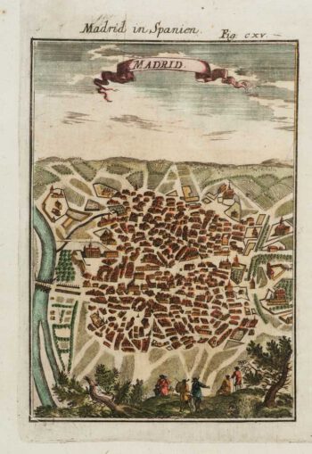
A 17th century prospect of Madrid
£150MALLET, Alain Manesson.
Published In 1684
Stock No. 12100 -

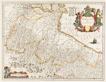
Classic 17th century Blaeu map of Romagna
£300BLAEU, Johannes.
Published In 1640
Stock No. 12069 -

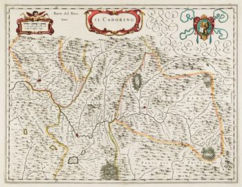
17th century map of Cadore
£200BLAEU, Johannes.
Published In 1640
Stock No. 12068 -

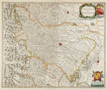
17th century map of Emilia Romagna
£225BLAEU, Johannes.
Published In 1640
Stock No. 12048 -

17th century map of China
£1,200LOON, Jan van.
Published In 1690
Stock No. 11964 -
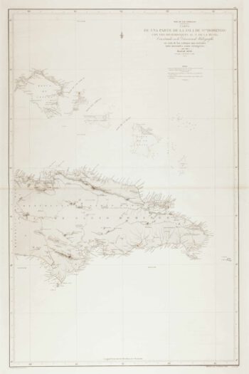
An uncommon 19th century Spanish sea chart of the Dominican Republic
£100MOUCHEZ, Amédée Ernest Barthémy.
Published In 1865
Stock No. 11846 -

An uncommon 19th century Spanish sea chart of the Dominican Republic & the Turks and Caicos Islands
£550BREGANTE, F.
Published In 1867
Stock No. 11838 -

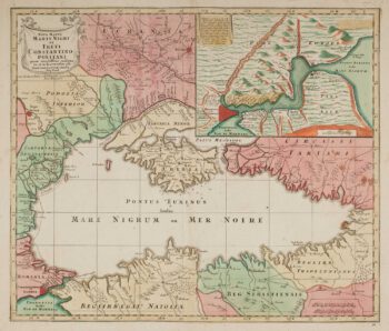
Map of the Black Sea in original colour
£580LOTTER, Tobias Conrad.
Published In 1760
Stock No. 12175