- Reset all
- Abruzzo
- Bahamas
- Balearics
- British Isles
- British Isles Maps
- Calabria
- California
- Campania
- Celestial
- Central America
- Central Europe
- Channel Islands
- China
- Cornwall
- Denmark
- Dorset
- Europe
- Georgia
- Gibraltar
- Greece
- Hong Kong
- Hungary
- Ionian Islands
- Ischia
- Korea
- Lombardy
- London Environs
- Maritime
- Monaco
- Moon
- Moscow
- Munster
- Near East
- Norfolk
- North America
- Panama
- Paris
- Provence
- South America
- Spain
- St Helena
- Staffordshire
- Syria
- Turkey
- Vietnam
- Zodiac
Showing 37–48 of 1712 results
-

Munster’s map of the Iberian Peninsula
£400MUNSTER, Sebastian.
Published In 1572
Stock No. 24579 -

A 16th century woodcut prospect of Rome
£400MUNSTER, Sebastian.
Published In 1572
Stock No. 24577 -

A 16th century woodcut map of Greece
£380MUNSTER, Sebastian.
Published In 1572
Stock No. 24576 -

A 16th century woodcut map of Classical Rome
£220MUNSTER, Sebastian.
Published In 1572
Stock No. 24572 -
A 16th century woodcut map of Switzerland
£400MUNSTER, Sebastian.
Published In 1572
Stock No. 24570 -
Early decorative birdseye view of Cusco
£380MUNSTER, Sebastian.
Published In 1572
Stock No. 24566 -

An unusual map of South America
£385KIRCHER, Athanasius.
Published In 1678
Stock No. 24560 -
An early 18th century map of the Middle East
£450CHATELAIN, Henri Abraham.
Published In 1720
Stock No. 24551 -

18th century map of China
£320TIRION, Isaak.
Published In 1740
Stock No. 24547 -

A scarce map of the Holy Land in the 18th century
£250FER, Nicolas de.
Published In 1707
Stock No. 24525 -

A scarce map of the Holy Land in Biblical times
£250FER, Nicolas de.
Published In 1707
Stock No. 24524 -

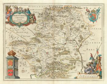
The uncommon Spanish edition of Blaeu’s map of Hertfordshire
£450BLAEU, Johannes.
Published In 1662
Stock No. 24521