Showing 37–48 of 1078 results
-

A Victorian plan of London
£750WYLD, James.
Published In 1859
Stock No. 23945 -

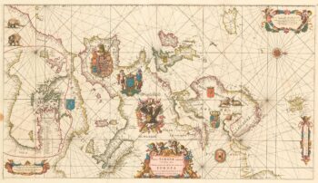
An exceptional 17th century sea chart of Europe on two sheets
£7,500DE WIT, Frederick.
Published In 1675
Stock No. 23450 -

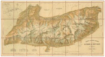
A detailed plan of the Mont-Blanc massif
£1,600BARBEY, Albert.
Published In 1924
Stock No. 22980 -

A monumental wall map of Spain early in the War of the Spanish Succession
£12,000FER, Nicolas de.
Published In 1704
Stock No. 24125 -

A detailed 19th century survey of South Australia
£950HARRIS, W.G.
Published In 1862
Stock No. 24105 -

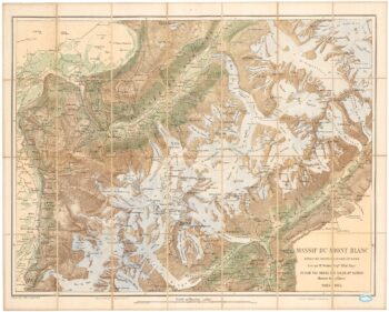
An important map of the Mont Blanc Massif
£950MIEULET, Jean-Joseph.
Published In 1865
Stock No. 24076 -

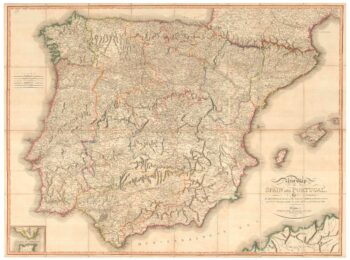
A large map of Iberia published during the Peninsular War
£750CHANLAIRE, Pierre Gregoire & MENTELLE, Edme.
Published In 1808
Stock No. 24072 -

Folding map of Australia with fine colour
£980WYLD, James.
Published In 1833
Stock No. 24071 -

A two-sheet map of Europe
£1,000JAILLOT, Alexis-Hubert.
Published In 1705
Stock No. 24059 -

The most important prospect of Brescia
£18,000CARBONI, Domenico.
Published In 1764
Stock No. 23648 -

A detailed map of Victoria in the 1930s
£4,500WAR OFFICE.
Published In 1930
Stock No. 23458 -

An impressive 16th century two-sheet plan of Antwerp
£1,500HOEFNAGEL, Joris.
Published In 1596
Stock No. 23372