Showing 1–12 of 417 results
-

An unusual 18th century map of the Holy Land
£800SEUTTER, Matth?us.
Published In 1745
Stock No. 24605 -

A plan of Jerusalem after Adrichom
£750SEUTTER, Matth?us.
Published In 1730
Stock No. 24600 -

An early woodcut map of the Holy Land
£850MUNSTER, Sebastian.
Published In 1552
Stock No. 24569 -

An 18th century map of North America
£1,200WEIGEL, Christoph.
Published In 1718
Stock No. 24541 -

17th century prospect of Biblical Jerusalem
£1,000DAPPER, Olfert.
Published In 1677
Stock No. 24540 -

18th century Italian map of the West Indies
£550CASSINI, Giovanni Maria.
Published In 1798
Stock No. 24532 -

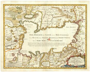
An 18th century map of the Caspian Sea
£700DE ROSSI, Domenico.
Published In 1723
Stock No. 24517 -

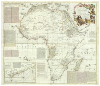
An 18th century wall map of Africa
£2,000ANVILLE, Jean Baptiste B. D'.
Published In 1772
Stock No. 24498 -

Ortelius’s map of Barbary in fine colour
£600ORTELIUS, Abraham.
Published In 1603
Stock No. 23807 -

A mid-18th century map of North America
£850LOTTER, Tobias Conrad.
Published In 1765
Stock No. 24610 -

A 17th century Dutch map of the West Indies
£1,250VISSCHER, Nicolas.
Published In 1710
Stock No. 24608 -

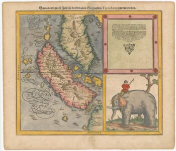
Woodblock map of Sumatra and the Malay Peninsula
£495MUNSTER, Sebastian.
Published In 1588
Stock No. 24584