Showing 145–156 of 200 results
-

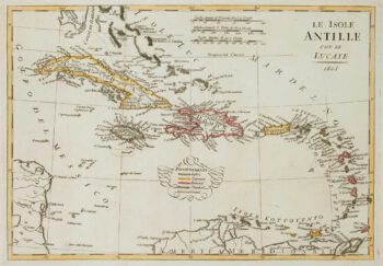
Early 19th century map of the West Indies
£150GUTHRIE, William.
Published In 1804
Stock No. 17251 -

Pictorial map of Prussia
£450ALEPH [HARVEY, William].
Published In 1869
Stock No. 17244 -

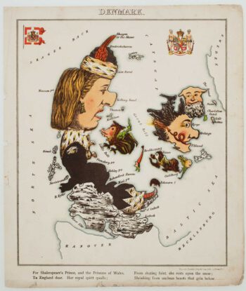
Pictorial map of Denmark
£400ALEPH [HARVEY, William].
Published In 1869
Stock No. 17242 -

Pictorial map of Germany
£450ALEPH [HARVEY, William].
Published In 1869
Stock No. 17241 -

Pictorial map of France
£450ALEPH [HARVEY, William].
Published In 1869
Stock No. 17237 -

Havana during the Seven Years’ War
£220GENTLEMAN'S MAGAZINE.
Published In 1762
Stock No. 17218 -

Havana during the Seven Years’ War
£500HINTON, John.
Published In 1762
Stock No. 17097 -

An 18th century chart of Western Ireland
£225SELLER, John.
Published In 1748
Stock No. 16956 -

An 18th century chart of Matanzas Bay
£160PEARSON, Robert.
Published In 1748
Stock No. 16952 -

Captain Cook’s first edition map of New Guinea
£220COOK, James.
Published In 1773
Stock No. 16716 -

Double-sided poster map of the Europe and Pacific Theatres of WW2
£750BUREAU OF NAVAL PERSONNEL.
Published In 1944
Stock No. 16657 -

Map of Abyssinia with the Kingdom of Prester John
£500QUAD, Matthias.
Published In 1600
Stock No. 18351