Showing 1–12 of 67 results
-

An early woodcut map of Scandinavia
£1,100MUNSTER, Sebastian.
Published In 1572
Stock No. 24567 -
An early 18th century map of the Middle East
£450CHATELAIN, Henri Abraham.
Published In 1720
Stock No. 24551 -

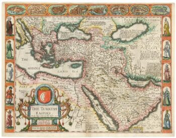
The first English atlas map of the Turkish Empire
£2,500SPEED, John.
Published In 1665
Stock No. 23981 -

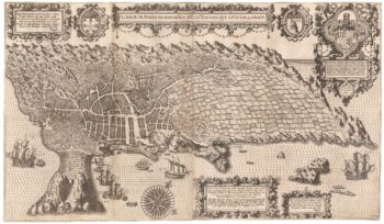
An important 16th century plan of Angra
£2,800LINSCHOTEN, Jan Huygen van.
Published In 1595
Stock No. 23737 -

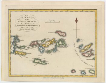
An 18th century map of the Virgin Islands
£700EDWARDS, Bryan.
Published In 1794
Stock No. 24169 -

Read’s map of Napoleon’s exile on St Helena, Second State
£1,200READ, R.P.
Published In 1817
Stock No. 22662 -

Napoleon in exile on St Helena
£1,400READ, R.P.
Published In 1815
Stock No. 22661 -

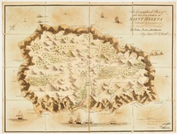
Read’s map of Napoleon’s exile on St Helena, First State
£1,200READ, R.P.
Published In 1815
Stock No. 22660 -

18th century map of Nubia and Abyssinia
£350CASSINI, Giovanni Maria.
Published In 1798
Stock No. 13313 -

Late 18th century map of Florida & Georgia
£550TARDIEU, Pierre Fran?ois.
Published In 1795
Stock No. 23906 -

The Genealogies of the Palaiologan Emperors and Ottoman Sultans
£950ROGG, Gottfried.
Published In 1755
Stock No. 23856 -

A miniature map of Mahe
£190WATERLOW & SONS LTD
Published In 1900
Stock No. 23635