Showing 505–516 of 533 results
-

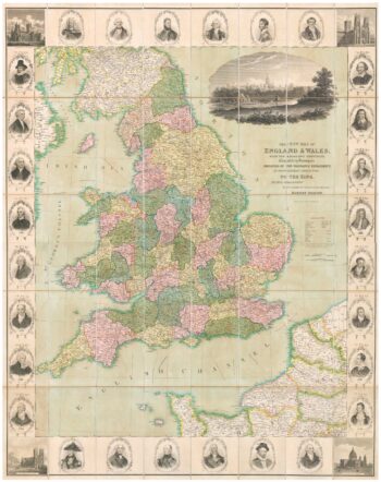
A decorative wall map of England & Wales
£1,500SEATON, Robert.
Published In 1835
Stock No. 10838 -

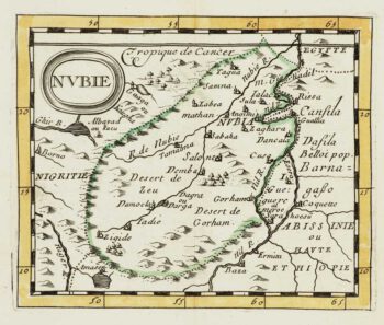
Miniature map of Nubia
£80DU VAL, Pierre.
Published In 1682
Stock No. 10830 -

Miniature map of Peru
£80DU VAL, Pierre.
Published In 1682
Stock No. 10824 -

Abyssinia, with the mythical kingdom of Prester John
£280MONTANUS, Arnoldus.
Published In 1670
Stock No. 10724 -

Four-sheet folding map of England & Wales
£800CREIGHTON, R.
Published In 1839
Stock No. 10621 -

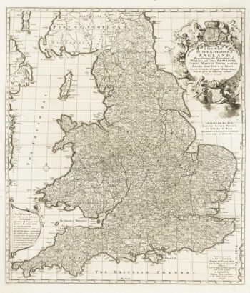
An Anglo-Dutch separate-issue road map of England
£480VISSCHER, Nicolas.
Published In 1694
Stock No. 10557 -

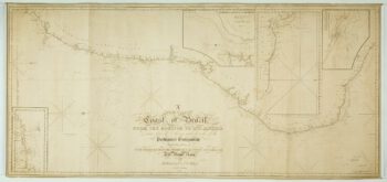
A detailed American ‘blue-back’ sea chart of the Brazilian coastline
£1,200BLUNT, E. & G.W.
Published In 1840
Stock No. 10336 -

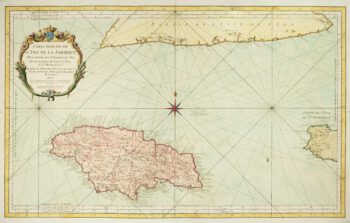
A large chart of Jamaica
£425BELLIN, Jacques-Nicolas.
Published In 1753
Stock No. 10124 -

Early 18th century view of Paris
£580AA, Pieter van der.
Published In 1715
Stock No. 9942 -

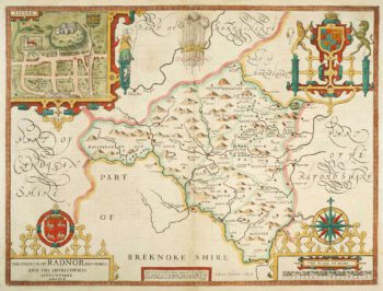
Speed’s county map of Radnor
£280SPEED, John.
Published In 1676
Stock No. 9874 -

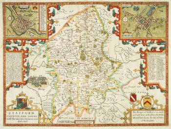
Staffordshire
£620SPEED, John.
Published In 1676
Stock No. 9870 -

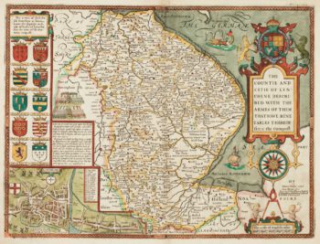
17th century English map of Lincolnshire
£800SPEED, John.
Published In 1676
Stock No. 9869