Showing 13–24 of 111 results
-

Late 18th century map of Florida & Georgia
£550TARDIEU, Pierre Fran?ois.
Published In 1795
Stock No. 23906 -

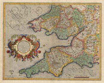
Mercator’s map of south west England
£380MERCATOR, Gerard.
Published In 1613
Stock No. 23867 -

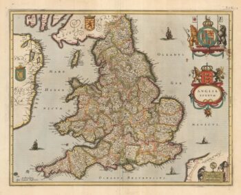
Early issue of Jansson’s map of England and Wales
£450JANSSON, Jan.
Published In 1638
Stock No. 23862 -

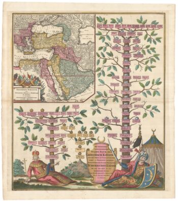
The Genealogies of the Palaiologan Emperors and Ottoman Sultans
£950ROGG, Gottfried.
Published In 1755
Stock No. 23856 -

Map of Sumatra and the Malay Peninsula
£425AA, Pieter van der.
Published In 1714
Stock No. 23647 -

The Strait of Malacca & Singapore
£475AA, Pieter van der.
Published In 1714
Stock No. 23646 -

18th century view of the Dutch city of Batavia
£160SALMON, Thomas.
Published In 1753
Stock No. 23642 -

Map of the Ottoman Empire with decorative vignettes
£150TALLIS, John.
Published In 1851
Stock No. 23499 -

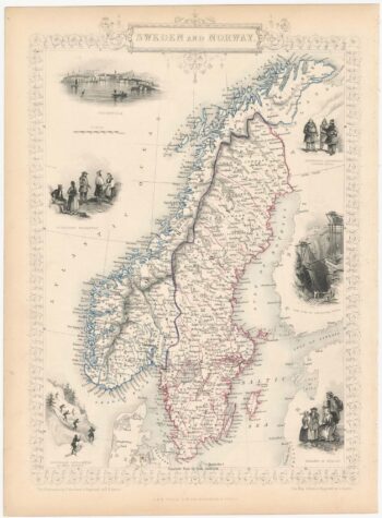
Decorative map of Sweden and Norway
£160TALLIS, John.
Published In 1851
Stock No. 23485 -

18th century plan of Paris in the decade before the French Revolution
£850ALIBERT, Jean.
Published In 1780
Stock No. 23420 -

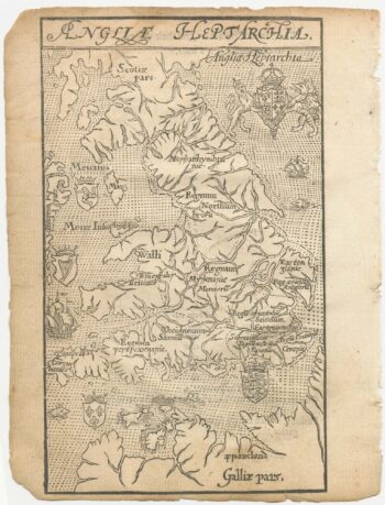
A 16th century woodcut map of England and Wales
£750LYNE, Richard.
Published In 1596
Stock No. 23298 -

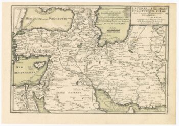
Early 18th century map of the Ottoman Empire and Persia
£240FER, Nicolas de.
Published In 1705
Stock No. 23242