Showing 1–12 of 49 results
-

An early woodcut map of Scandinavia
£1,100MUNSTER, Sebastian.
Published In 1572
Stock No. 24567 -
An early 18th century map of the Middle East
£450CHATELAIN, Henri Abraham.
Published In 1720
Stock No. 24551 -

18th century plan of Stockholm
£220KITCHIN, Thomas.
Published In 1784
Stock No. 20454 -

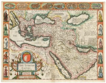
The first English atlas map of the Turkish Empire
£2,500SPEED, John.
Published In 1665
Stock No. 23981 -

Five scarce Italian playing cards depicting Sweden and the Baltic
£700Anonymous.
Published In 1790
Stock No. 24237 -

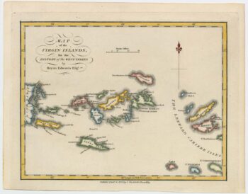
An 18th century map of the Virgin Islands
£700EDWARDS, Bryan.
Published In 1794
Stock No. 24169 -

18th century map of Nubia and Abyssinia
£350CASSINI, Giovanni Maria.
Published In 1798
Stock No. 13313 -

A 16th century town plan of Stockholm
£350VALEGIO, Francesco.
Published In 1598
Stock No. 24177 -

Late 18th century map of Florida & Georgia
£550TARDIEU, Pierre Fran?ois.
Published In 1795
Stock No. 23906 -

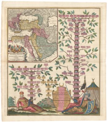
The Genealogies of the Palaiologan Emperors and Ottoman Sultans
£950ROGG, Gottfried.
Published In 1755
Stock No. 23856 -

Map of the Ottoman Empire with decorative vignettes
£150TALLIS, John.
Published In 1851
Stock No. 23499 -

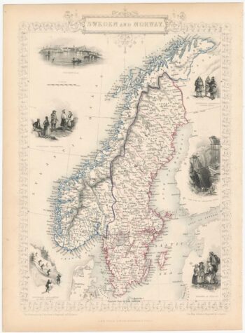
Decorative map of Sweden and Norway
£160TALLIS, John.
Published In 1851
Stock No. 23485