- Reset all
- Adriatic Sea
- Andalusia
- Antarctic
- Antigua
- Basque Regions
- Benelux
- Burma
- Central America
- China
- Falklands
- Gulf States
- Hertfordshire
- Holy Land
- Indian Ocean
- Liguria
- Luxembourg
- Maritime
- North Africa
- Northern Italy
- Portugal
- Sardinia
- Scandinavia
- Scientific Instruments
- Scottish Islands
- Singapore
- Somerset
- Texas
- Trentino
- West Indies
- Zodiac
Showing 37–48 of 537 results
-

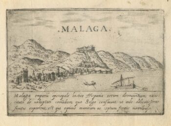
A 16th century town plan of Malaga
£270VALEGIO, Francesco.
Published In 1598
Stock No. 24184 -

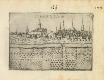
A 16th century town plan of Copenhagen
£290VALEGIO, Francesco.
Published In 1598
Stock No. 24179 -

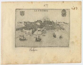
A 16th century town plan of Lisbon
£300VALEGIO, Francesco.
Published In 1598
Stock No. 24174 -

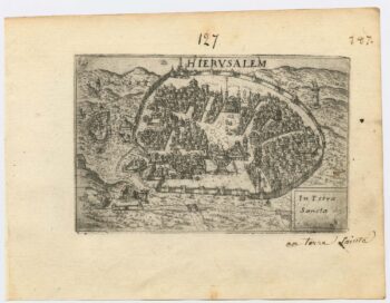
A 16th century town plan of Jerusalem
£450VALEGIO, Francesco.
Published In 1598
Stock No. 24161 -

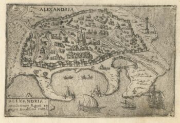
A 16th century Italian plan of Alexandria
£240VALEGIO, Francesco.
Published In 1598
Stock No. 24149 -

Mid 19th century map of Belgium with decorative vignettes
£120TALLIS, John.
Published In 1851
Stock No. 21637 -

18th century plan of Stockholm
£220KITCHIN, Thomas.
Published In 1784
Stock No. 20454 -

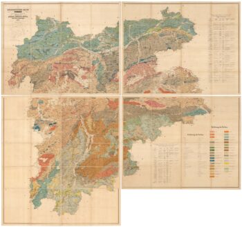
A geological map of the Duchy of Tyrol
£2,350STOTTER, Michael.
Published In 1851
Stock No. 23050 -

16th century map of the Eastern Mediterranean in rare early colour
£880MUNSTER, Sebastian.
Published In 1550
Stock No. 24441 -

A view of the Battle of Lepanto engraved in 1572
£2,500CAVALIERI, Giovanni Battista de'.
Published In 1647
Stock No. 24486 -

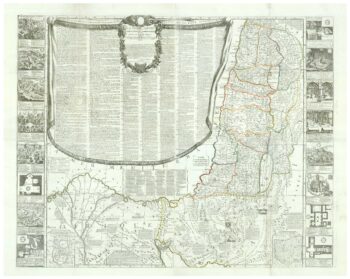
A rare wall map of the Holy Land
£9,000NOLIN, Jean Baptiste.
Published In 1785
Stock No. 24500 -

An instructional card explaining shipboard directions
£220Anonymous.
Published In 1840
Stock No. 24472