- Reset all
- Adriatic Sea
- Andalusia
- Antarctic
- Australia
- Balkan maps
- Benelux
- Central America
- Eastern Europe
- Emilia Romagna
- Hertfordshire
- Holy Land
- Indian Ocean
- Madeira
- Map Games
- Northern Italy
- Pacific Islands
- Piedmont
- Scandinavia
- Scientific Instruments
- Scottish Islands
- Singapore
- Sri Lanka
- Texas
- Wiltshire
- Wind Roses
Showing 397–408 of 441 results
-

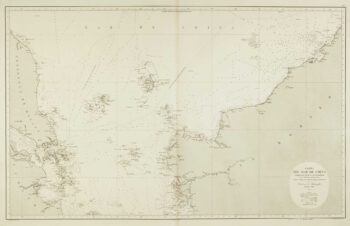
Sea chart of the South China Sea
£750DE LORENZO, J.
Published In 1864
Stock No. 12457 -

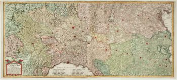
A two-sheet old map of the Po River
£1,300CERRUTI, Agostino.
Published In 1735
Stock No. 12221 -

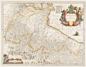
Classic 17th century Blaeu map of Romagna
£300BLAEU, Johannes.
Published In 1640
Stock No. 12069 -

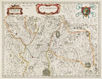
17th century map of Cadore
£200BLAEU, Johannes.
Published In 1640
Stock No. 12068 -

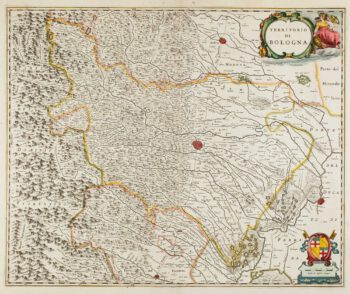
17th century map of Emilia Romagna
£225BLAEU, Johannes.
Published In 1640
Stock No. 12048 -

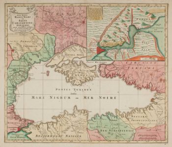
Map of the Black Sea in original colour
£580LOTTER, Tobias Conrad.
Published In 1760
Stock No. 12175 -

Russia at the beginning of the reign of Peter the Great
£825DU VAL, Pierre.
Published In 1686
Stock No. 11447 -

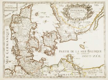
17th century French map of Denmark
£200DU VAL, Pierre.
Published In 1686
Stock No. 11443 -

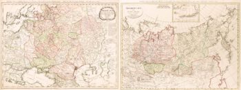
Two-sheet map of the Russian Empire
£1,200MANNERT, Konrad.
Published In 1794
Stock No. 11414 -

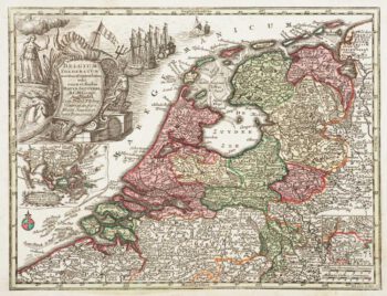
Holland with an Inset of its colonies in the East Indies
£280SEUTTER, Matthaus.
Published In 1744
Stock No. 11407 -

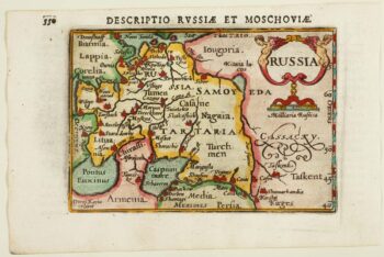
An early 17th century miniature map of Russia
£200BERTIUS, Petrus.
Published In 1603
Stock No. 11401 -

Luxembourg
£150SEUTTER, Matthaus.
Published In 1744
Stock No. 11397