Showing 565–576 of 631 results
-

Sea chart of the Firth of Forth from the first English sea-atlas
£480COLLINS, Greenvile.
Published In 1750
Stock No. 14900 -

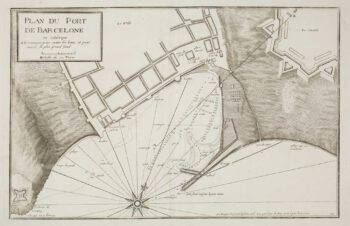
A scarce sea chart of Barcelona Harbour
£300AYROUARD, Jacques.
Published In 1746
Stock No. 14127 -

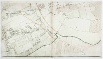
Knightsbridge from an important large-scale survey of London
£600HORWOOD, Richard.
Published In 1794
Stock No. 14121 -

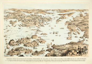
Ariel view of Helsinki and the Fortress of Sveaborg during the Crimean War
£800PACKER, Thomas.
Published In 1855
Stock No. 14080 -

Detailed map of Oman, with Muscat marked
£750VANDERMAELEN, Philippe.
Published In 1827
Stock No. 14074 -

Walworth from an important large-scale survey of London
£550HORWOOD, Richard.
Published In 1799
Stock No. 12672 -

Westminster and Lambeth from an important large-scale survey of London
£1,100HORWOOD, Richard.
Published In 1799
Stock No. 12670 -

Marylebone & St Pancras from an important large-scale survey of London
£900HORWOOD, Richard.
Published In 1799
Stock No. 12668 -

A history of London through maps
£20WHITFIELD, Peter.
Published In 2006
Stock No. 12441 -

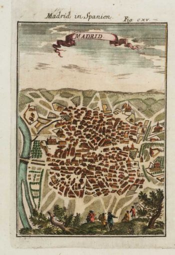
A 17th century prospect of Madrid
£150MALLET, Alain Manesson.
Published In 1684
Stock No. 12100 -

An uncommon 19th century old sea chart of western India
£750DIRECCION HIDROGRAFICA DE MADRID.
Published In 1870
Stock No. 12284 -

An uncommon 19th century Spanish sea chart of south west India with Lakshadweep
£650DIRECCION HIDROGRAFICA DE MADRID.
Published In 1870
Stock No. 12283