Showing 1–12 of 15 results
-

An advert for an American railway
£750Anonymous.
Published In 1865
Stock No. 24455 -

An extremely rare example of the first printed plan of Exeter
£4,500HOOKER, John.
Published In 1587
Stock No. 24437 -

Miniature map of Devon
£80PERROT, Aristide Michel.
Published In 1828
Stock No. 23303 -

A scarce issue of John Speed’s map of Devon
£1,100SPEED, John.
Published In 1611
Stock No. 24038 -

The Speed map of New England
£6,500SPEED, John.
Published In 1676
Stock No. 23794 -

A rare German edition of John Smith’s map of New England
£9,000SMITH, John.
Published In 1617
Stock No. 21888 -

Sea chart of Plymouth from the first English sea-atlas
£450COLLINS, Greenvile.
Published In 1693
Stock No. 21702 -

A 17th century Dutch sea chart of the Adriatic
£800GOOS, Pieter.
Published In 1660
Stock No. 21024 -

The Eastern Seaboard with the ‘Restitutio’ view of New York
£8,000ALLARD, Hugo.
Published In 1725
Stock No. 18268 -

A detailed Victorian plan of Plymouth
£120TALLIS, John.
Published In 1851
Stock No. 17732 -

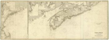
A working sea chart of the northern Eastern Seaboard
£2,600APPLETON, J.W.
Published In 1880
Stock No. 17408 -

An uncommon Spanish sea chart of the Eastern Seaboard
£550NOGUERA, C.
Published In 1860
Stock No. 11859