- Reset all
- Advertising
- Argentina
- Bering Strait
- Bolivia
- British Isles
- Canada
- Devon
- Eastern Europe
- Eastern Seaboard Maps
- Elba
- Frontispieces
- Gulf States
- Hertfordshire
- Lancashire
- Latvia and Estonia
- Leicestershire
- Madeira
- Maritime
- Morocco
- Netherlands
- North America Maps
- Northamptonshire
- Nottinghamshire
- Poland
- Prints
- Russia
- Scottish Islands
- Solar System
- Switzerland
- Trentino
- United States
- Vietnam
- Virginia
- Westmorland
- World and Continents
Showing 673–684 of 709 results
-

An uncommon Spanish sea chart of the Eastern Seaboard
£550NOGUERA, C.
Published In 1860
Stock No. 11859 -
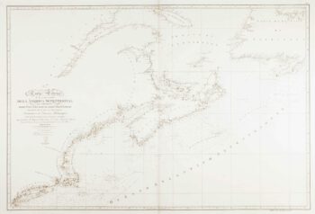
An uncommon Spanish sea chart of the Eastern Seaboard
£1,700NOGUERA, C.
Published In 1860
Stock No. 11858 -

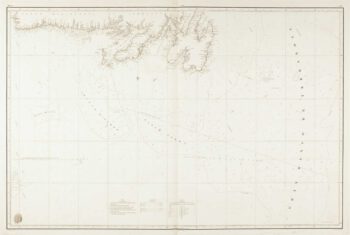
A scarce Spanish two-sheet sea chart of Newfoundland
£1,200MORENO, Miguel.
Published In 1860
Stock No. 11852 -

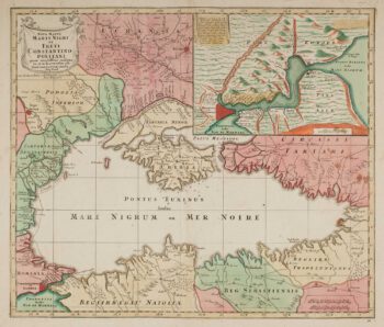
Map of the Black Sea in original colour
£580LOTTER, Tobias Conrad.
Published In 1760
Stock No. 12175 -

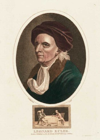
A colour-printed stipple portrait of Leonhard Euler
£220CHAPMAN, J.
Published In 1804
Stock No. 11809 -

Russia at the beginning of the reign of Peter the Great
£825DU VAL, Pierre.
Published In 1686
Stock No. 11447 -

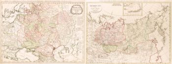
Two-sheet map of the Russian Empire
£1,200MANNERT, Konrad.
Published In 1794
Stock No. 11414 -

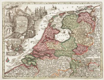
Holland with an Inset of its colonies in the East Indies
£280SEUTTER, Matthaus.
Published In 1744
Stock No. 11407 -

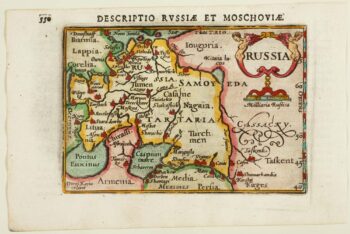
An early 17th century miniature map of Russia
£200BERTIUS, Petrus.
Published In 1603
Stock No. 11401 -

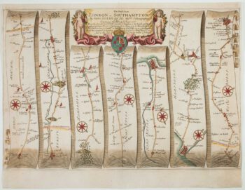
The road from Bagshot to Southampton and on to Salisbury
£380OGILBY, John.
Published In 1675
Stock No. 11367 -

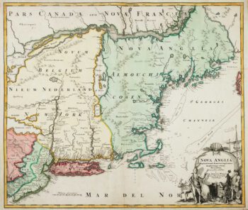
The English colonies on the north-east seaboard of America
£1,450HOMANN, Johann Baptist.
Published In 1725
Stock No. 11207 -

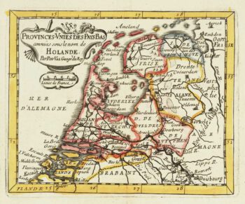
Miniature map of Holland
£140DU VAL, Pierre.
Published In 1682
Stock No. 10859