Showing 1–12 of 23 results
-

A 16th century map of the colony of New Spain
£750ORTELIUS, Abraham.
Published In 1584
Stock No. 24448 -

An Air France poster map of the world in a double hemisphere
£1,900BOUCHER, Lucien.
Published In 1950
Stock No. 23336 -

A 17th century county map of Wiltshire, with a rogue village
£1,100SPEED, John.
Published In 1665
Stock No. 23781 -

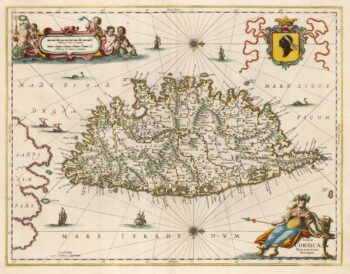
A decorative 17th century map of Corsica
£1,100JANSSON, Jan.
Published In 1650
Stock No. 23619 -

Map of the Channel Islands of Jersey & Guersney
£125TALLIS, John.
Published In 1851
Stock No. 23517 -

James Boswell’s 18th century tour of Corsica
£680PHINN, Thomas.
Published In 1768
Stock No. 23174 -

A rare Italian map of Corsica
£1,800SOCIETA CALCOGRAFICA.
Published In 1805
Stock No. 23173 -

A 16th century map of Corsica
£260PORCACCHI, Tomaso.
Published In 1590
Stock No. 23212 -

Mid-17th century map of Mexico
£950SANSON, Nicolas.
Published In 1658
Stock No. 22742 -

A scarce 17th century map of Corsica
£1,100BLAEU, Johannes.
Published In 1663
Stock No. 22580 -

New Spain from the first English Edition of the ‘Atlas Minor’
£220HONDIUS, Jodocus.
Published In 1635
Stock No. 22381 -

An 18th century chart of Bastia, Corsica
£80ROUX, Joseph.
Published In 1764
Stock No. 21734