Showing 1–12 of 38 results
-

A 16th century town plan of Rhodes
£250ROTA, Martin.
Published In 1598
Stock No. 24199 -

A serio-comic map of Europe with the Russian octopus
£4,750GROSSI, Augusto.
Published In 1878
Stock No. 24393 -

A French serio-comic map of Europe for the Great War
£1,850CRETE, B.
Published In 1915
Stock No. 23347 -

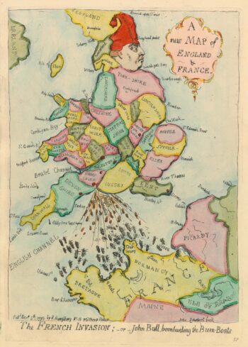
Caricature map of England in danger of invasion, from Gillray’s cruder output
£1,250GILLRAY, James.
Published In 1851
Stock No. 24158 -

A scarce 16th century map of the South Pole and the Strait of Magellan
£3,000WYTFLIET, Cornelis van.
Published In 1597
Stock No. 23439 -

A scarce map of Kos
£350CORONELLI, Vincenzo Maria.
Published In 1700
Stock No. 23371 -

A scarce map of Riniea & Dilos
£350CORONELLI, Vincenzo Maria.
Published In 1700
Stock No. 23370 -
The medieval Castle of Pandeli on Leros
£350CORONELLI, Vincenzo Maria.
Published In 1700
Stock No. 23366 -

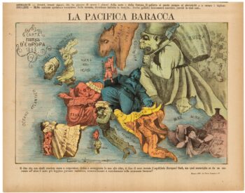
A rare Italian serio-comic map of Europe in 1871
£20,000MANFREDO, Manfredi.
Published In 1871
Stock No. 23283 -

An Italian edition of Hadol’s serio-comic map of Europe
£1,200HADOL, Paul.
Published In 1888
Stock No. 23202 -
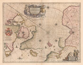
A 17th century map of the early exploration of the Arctic Circle
£1,250BLAEU, Johannes.
Published In 1662
Stock No. 23200 -

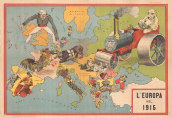
An Italian Serio-Comic map of Europe during the Great War
£2,500Anonymous.
Published In 1915
Stock No. 22636