Showing 253–264 of 267 results
-

A history of London through maps
£20WHITFIELD, Peter.
Published In 2006
Stock No. 12441 -

18th century view of Westminster from the Thames
£1,100FARINGTON, Joseph.
Published In 1790
Stock No. 11595 -

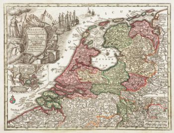
Holland with an Inset of its colonies in the East Indies
£280SEUTTER, Matthaus.
Published In 1744
Stock No. 11407 -

Luxembourg
£150SEUTTER, Matthaus.
Published In 1744
Stock No. 11397 -

A circular plan of London and Environs
£1,000PIGOT, James.
Published In 1832
Stock No. 11253 -

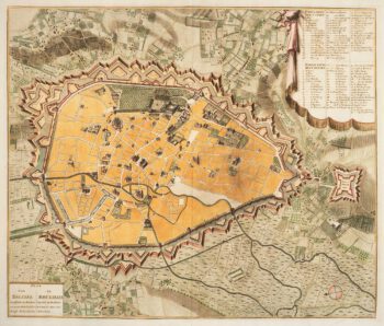
Town plan of Brussels in the 18th century
£500HUCHTENBURG, J. van.
Published In 1729
Stock No. 11162 -

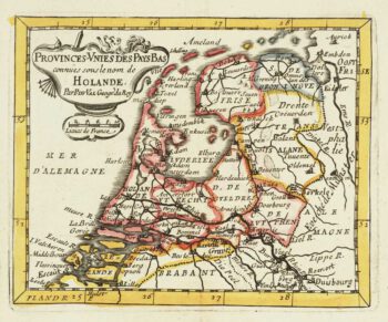
Miniature map of Holland
£140DU VAL, Pierre.
Published In 1682
Stock No. 10859 -

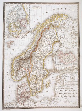
Detailed 19th century map of Scandinavia
£160BRUÉ, Adrien Hubert.
Published In 1825
Stock No. 10277 -

Early townplan of Sluis in Belgium
£220BRAUN, Georg & HOGENBERG, Frans.
Published In 1581
Stock No. 9914 -

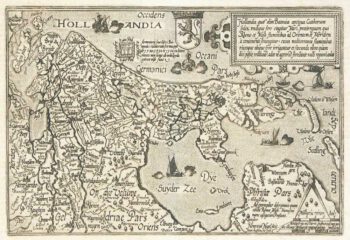
Holland
£400QUAD, Matthias.
Published In 1600
Stock No. 9094 -

Friesland
£250JANSSON, Jan.
Published In 1666
Stock No. 8433 -

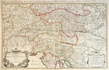
Two-sheet map of Austria
£350JAILLOT, Alexis-Hubert.
Published In 1705
Stock No. 8270