Showing 1–12 of 395 results
-

An unusual 18th century map of the Holy Land
£800SEUTTER, Matth?us.
Published In 1745
Stock No. 24605 -

Blaeu’s classic 17th century map of Iceland
£1,200BLAEU, Willem Janszoon.
Published In 1635
Stock No. 24604 -

A plan of Jerusalem after Adrichom
£750SEUTTER, Matth?us.
Published In 1730
Stock No. 24600 -

An early woodcut map of the Holy Land
£850MUNSTER, Sebastian.
Published In 1552
Stock No. 24569 -

An early woodcut map of Scandinavia
£1,100MUNSTER, Sebastian.
Published In 1572
Stock No. 24567 -

A large and detailed 19th century map of India
£750WALKER, John.
Published In 1829
Stock No. 24543 -

17th century prospect of Biblical Jerusalem
£1,000DAPPER, Olfert.
Published In 1677
Stock No. 24540 -

Four scarce Italian playing cards depicting Norway
£850Anonymous.
Published In 1790
Stock No. 24246 -

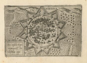
A 16th century town plan of Nicosia
£750VALEGIO, Francesco.
Published In 1598
Stock No. 24176 -

A rare 16th century Italian plan of Famagusta
£950VALEGIO, Francesco.
Published In 1598
Stock No. 24148 -

A 17th century map of of the Mogol Empire
£700CANTELLI DA VIGNOLA, Giacomo.
Published In 1683
Stock No. 24609 -
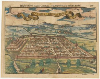
Early decorative birdseye view of Cusco
£380MUNSTER, Sebastian.
Published In 1572
Stock No. 24566