- Reset all
- Afghanistan
- Argentina
- Atlases and Books
- Beijing
- Bering Strait
- Bolivia
- Books
- Derbyshire
- Dorset
- Ecuador
- French Regions
- Iceland
- Ionian Islands
- Italy Maps
- Latvia and Estonia
- London
- Middlesex
- Moscow
- North Africa
- Pictorial Maps
- Seychelles
- South Africa
- Spain
- Wales
- West Coast
- West Indies
- Wind Roses
- World
Showing 541–552 of 592 results
-

Map of Bermuda and other islands in the Atlantic, with vignettes
£100TALLIS, John.
Published In 1851
Stock No. 12631 -

A history of London through maps
£20WHITFIELD, Peter.
Published In 2006
Stock No. 12441 -

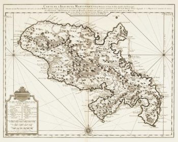
Map of 18th-century Martinique
£550JEFFERYS, Thomas.
Published In 1779
Stock No. 12317 -

18th century map of Martinique
£650COVENS & MORTIER.
Published In 1740
Stock No. 12311 -

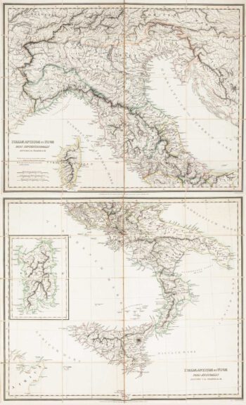
Two-sheet folding map of Italy
£650CRAMER. John Anthony.
Published In 1825
Stock No. 12143 -

The story of the Spanish Armada from the House of Lords tapestries
£800PINE, John.
Published In 1739
Stock No. 12117 -
The story of the Spanish Armada from the House of Lords tapestries
£800PINE, John.
Published In 1739
Stock No. 12114 -

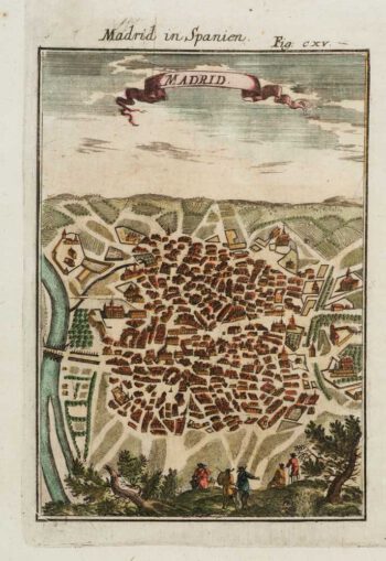
A 17th century prospect of Madrid
£150MALLET, Alain Manesson.
Published In 1684
Stock No. 12100 -

17th century sea-chart of the West Indies
£2,500GOOS, Pieter.
Published In 1666
Stock No. 11906 -

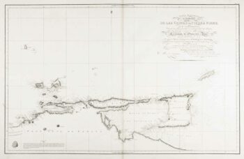
An uncommon 19th century Spanish sea chart of Trinidad and Venezuela
£1,500DIRECCION HIDROGRAFICA DE MADRID.
Published In 1865
Stock No. 11887 -

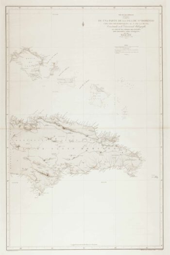
An uncommon 19th century Spanish sea chart of the Dominican Republic
£100MOUCHEZ, Amédée Ernest Barthémy.
Published In 1865
Stock No. 11846 -

An uncommon 19th century Spanish sea chart of the Dominican Republic & the Turks and Caicos Islands
£550BREGANTE, F.
Published In 1867
Stock No. 11838