
Showing 1–12 of 180 results
-
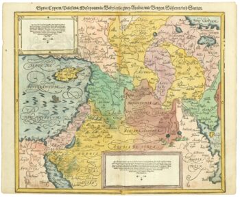
16th century map of the Eastern Mediterranean in rare early colour
£880MUNSTER, Sebastian.
Published In 1550
Stock No. 24441 -

A rare wall map of the Holy Land
£9,000NOLIN, Jean Baptiste.
Published In 1785
Stock No. 24500 -

London in the reign of William IV
£550SMITH, Charles.
Published In 1836
Stock No. 24428 -

An incunable prospect of Jerusalem
£1,600SCHEDEL, D. Hartmann.
Published In 1493
Stock No. 24425 -

17th century map of Arabia
£1,000MEURS, Jacob van.
Published In 1680
Stock No. 20175 -

Early 19th century plan of London
£350Anonymous.
Published In 1810
Stock No. 24505 -

An early 20th century plaster relief map of Jerusalem in a box
£1,200VESTER, Frederick.
Published In 1910
Stock No. 24365 -

A large scale map of Westmorland in fine colour
£1,500GREENWOOD, C. & J.
Published In 1824
Stock No. 24069 -

The first English atlas map of the Turkish Empire
£2,500SPEED, John.
Published In 1665
Stock No. 23981 -

A Victorian plan of London
£750WYLD, James.
Published In 1859
Stock No. 23945 -

A 17th century sea chart of the Gulf of Aden in Dudley’s unique style
£3,250DUDLEY, Robert.
Published In 1646
Stock No. 23592 -

The peregrinations of Abraham
£2,000ORTELIUS, Abraham.
Published In 1603
Stock No. 24384


