- Reset all
- Africa Continent
- Andalusia
- Antarctic
- Argentina
- Asia
- Australia
- Benelux
- Central America
- Emilia Romagna
- Far East Maps
- Hertfordshire
- Holy Land
- Indian Ocean
- Madeira
- Map Games
- Northern Italy
- Pacific Islands
- Patagonia
- Sardinia
- Scandinavia
- Scientific Instruments
- Scottish Islands
- Singapore
- Sri Lanka
- Suffolk
- Texas
- United States
- Wiltshire
- Wind Roses
Showing 733–744 of 797 results
-

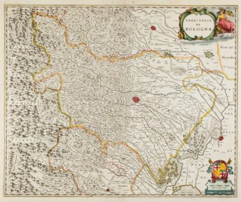
17th century map of Emilia Romagna
£225BLAEU, Johannes.
Published In 1640
Stock No. 12048 -

Early 17th century map of the Turkish Empire
£300HONDIUS, Jodocus.
Published In 1607
Stock No. 11990 -

17th century map of China
£1,200LOON, Jan van.
Published In 1690
Stock No. 11964 -

An uncommon Spanish sea chart of Georgia & South Carolina
£1,500DIRECCION HIDROGRAFICA DE MADRID.
Published In 1868
Stock No. 11862 -
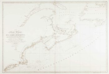
An uncommon Spanish sea chart of North Carolina
£2,000DE LORENZO, J.
Published In 1868
Stock No. 11861 -

An uncommon Spanish sea chart of the Eastern Seaboard
£550NOGUERA, C.
Published In 1860
Stock No. 11859 -
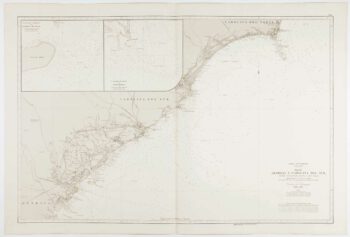
An uncommon Spanish sea chart of the Eastern Seaboard
£1,700NOGUERA, C.
Published In 1860
Stock No. 11858 -

An uncommon 19th century old sea chart of western India
£750DIRECCION HIDROGRAFICA DE MADRID.
Published In 1870
Stock No. 12284 -

An uncommon 19th century Spanish sea chart of south west India with Lakshadweep
£650DIRECCION HIDROGRAFICA DE MADRID.
Published In 1870
Stock No. 12283 -

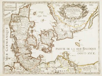
17th century French map of Denmark
£200DU VAL, Pierre.
Published In 1686
Stock No. 11443 -

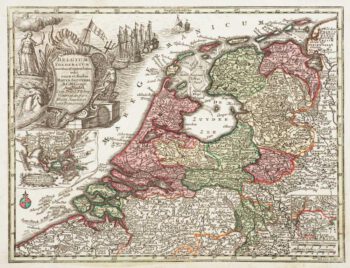
Holland with an Inset of its colonies in the East Indies
£280SEUTTER, Matthaus.
Published In 1744
Stock No. 11407 -

Luxembourg
£150SEUTTER, Matthaus.
Published In 1744
Stock No. 11397